Early Settlement Period (1): Pilgrims in Maine

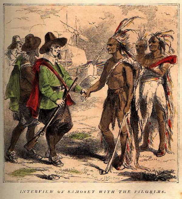
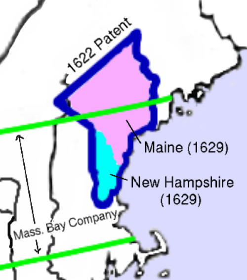
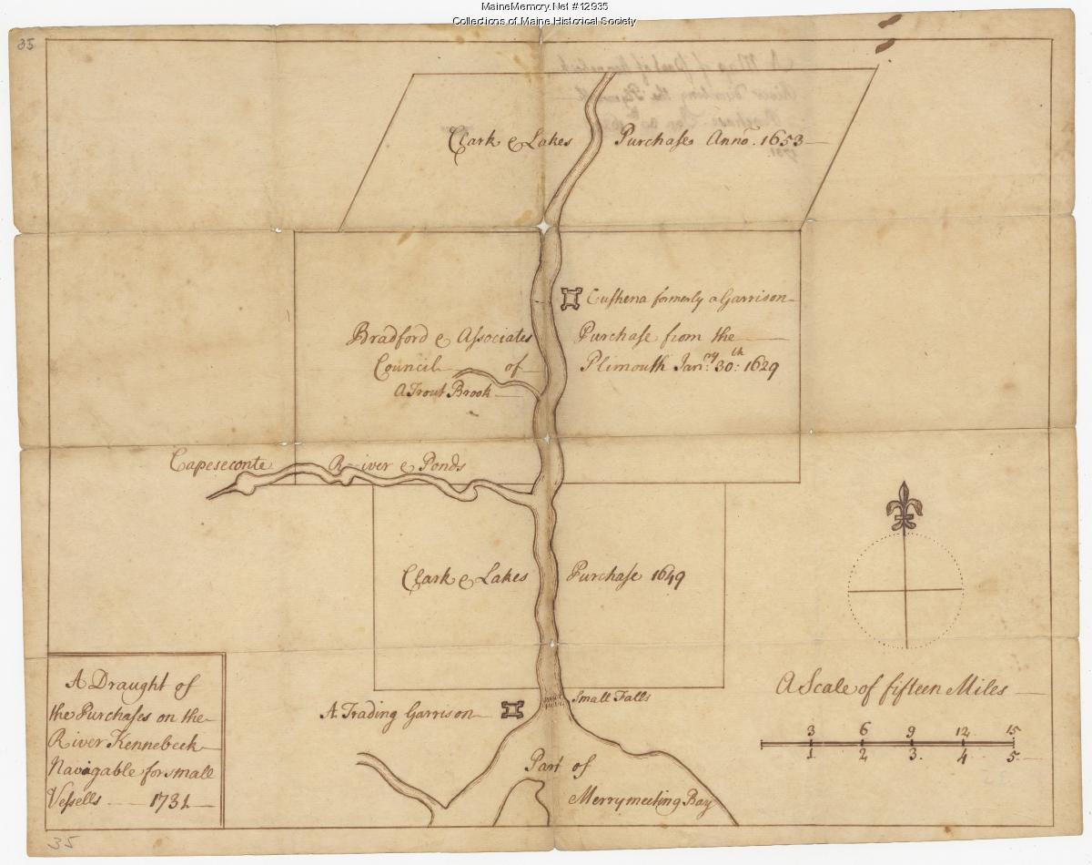
The Pilgrims of Plymouth made the first significant purchases of Indian land in the Kennebec Valley. In 1648, sachem Monquine (or Natahanada) sold the land on both sides of the Kennebec from Cushnoc to Wesserunset (Skowhegan) to William Bradford, governor of Plymouth Colony. This land was north of the colony’s previous grant from the Council of New England.

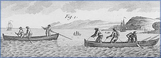
In 1650, Plymouth abandoned its trading post at Kenibec in the lower reaches of the Kennebec River in favor of a location upriver at Cushnoc, where they expected less competition.  However, the move was not without negative ramifications, as Baker (1986, p. 107) suggests: “While the move to Cushnoc to secure their trade may have seemed a good course of action at the time, Plymouth officials quickly recognized that they had made a tactical mistake. By taking Indian deeds, Plymouth colony had recognized the right of all Indians to sell their land. Plymouth’s action also suggested that the Indians themselves, and not the colony’s patent, were the source of clear titles to Kennebec lands. Finally, Plymouth’s acceptance of these deeds meant that the colony had to recognize the Indian deeds of its English competitors in the fur trade.”

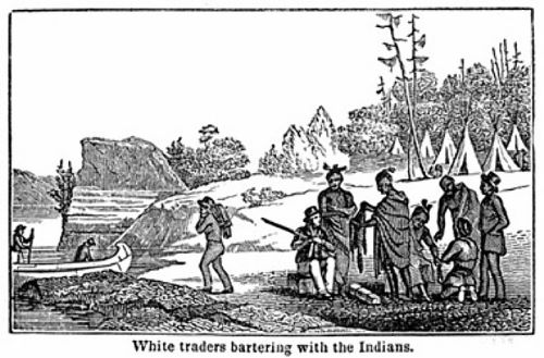
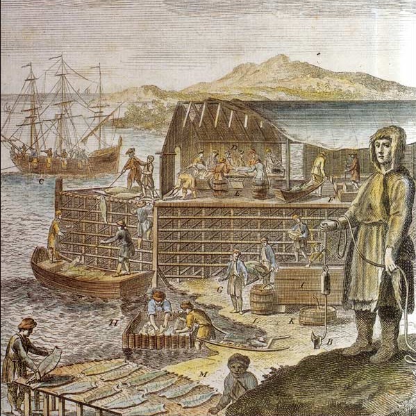
In 1649, the most significant competitor of the Plymouth Colony would emerge:  Thomas Lake. Lake was descended from a wealthy Lincolnshire family and was a wealthy Boston merchant who participated in the triangular trade of London, sending furs to England and boards, staves, fish, peas, and wheat to Barbados and the Wine Islands.

Lake, along with John Allen and Nicholas Shapleigh in 1641, obtained a massive patent encompassing thousands of acres of timber along the southern bank of the Piscataqua River and the north shore of Massachusetts. In 1649, as this area faced increasing deforestation,  Lake sent his agent Christopher Lawson to the Kennebec to purchase more land; joining with two new partners, Roger Spencer, and John Allen, he purchased two large tracts on the Kennebec from the local Wabanake.

As Baker (1986, pp. 108-109) describes: “One deed ran from “Swan Allie” (Swan Island) in Richmond north about thirteen miles to the mouth of the Cobboseecontee Stream and extended ten miles into the woods on both sides of the Kennebec. A second tract, overlapping property purchased by Plymouth in 1648, centered around Taconic (or Teconnet, the falls in present-day Waterville), stretching four miles above the falls and six miles below. This second tract also extended ten miles into the woods on both sides of the river. By 1653 trading posts had been set up on both tracts, one at Taconic and another at Neumkeag (not to be confused with Neguamkeag) on the east bank of the river at what is now Agry’s Point in Pittston. The Plymouth station at Cushnoc fell between these two trading posts, meaning that Wabanaki going either upriver or downriver would trade their furs with Lake’s men before reaching Cushnoc. A struggle to buy up Indian lands would quickly ensue between Lake and the Plymouth colonists.”

While Lakes’s strategy to take over trade on the Kennebec was sound, it was hampered by the fact that the northern tract he had purchased overlapped with the property bought by the Plymouth Colony. As Baker (1989, p. 240) again outlines: ” Abagadusset (or Bagadusset), an Indian who lived many miles downriver (in present-day Richmond), sold much of this tract to Thomas Lake, Roger Spencer, and Christopher Lawson. Plymouth Colony authorities then proceeded to take depositions from several Indians to confirm Pilgrim ownership. Essemenoque (also spelled Assiminisqua and Quesememecke), “one of the right owners of Toconett,” signed one of the depositions, stating that he had been aware of the sale of land by Monquine to Bradford, consented to it, and received “part of the pay.” While Essemenoque acknowledged that he and all the other Indians freely approved of Monquine’s transaction, he claimed that Abagadusset had no right to sell Taconic, for the land belonged to him and Watchogoe’s wife.”

In 1654, the Plymouth Colony and Thomas Lake resolved their difficulties by agreeing to specific property boundaries and uniting their separate truck houses into one fur-trading partnership.

However, from this point on, the Plymouth Companies’ profits plummeted. Several factors reduced its profitability. Not only were they competing with Clarke and Lakes’s southern trading posts, but many other independent “coasters” and small resident traders competed with them for furs. The distant Plymouth colony simply did not have the manpower to protect its jurisdiction along the river. Supplies of furs were also reduced in 1659 when a raiding party of Mohawks killed and kidnapped several Wabanaki, and the Maine Indians shifted their focus from trading furs to fighting the Iroquois. Governor Bradford, who had directed the Plymouth fur trade, also died in 1657.

As described by Baker (1986, p. 115): “Unwilling to expend energy and money on a distant territory and unable to profit from the bountiful fur supply of the Kennebec, the Plymouth Colony began seeking a buyer for the  Kennebec tract. In 1661, the colony sold the whole tract for £400 to four Boston merchants, John Winslow, Antipas Boyes, Edward Tyng, and Thomas Brattle.”

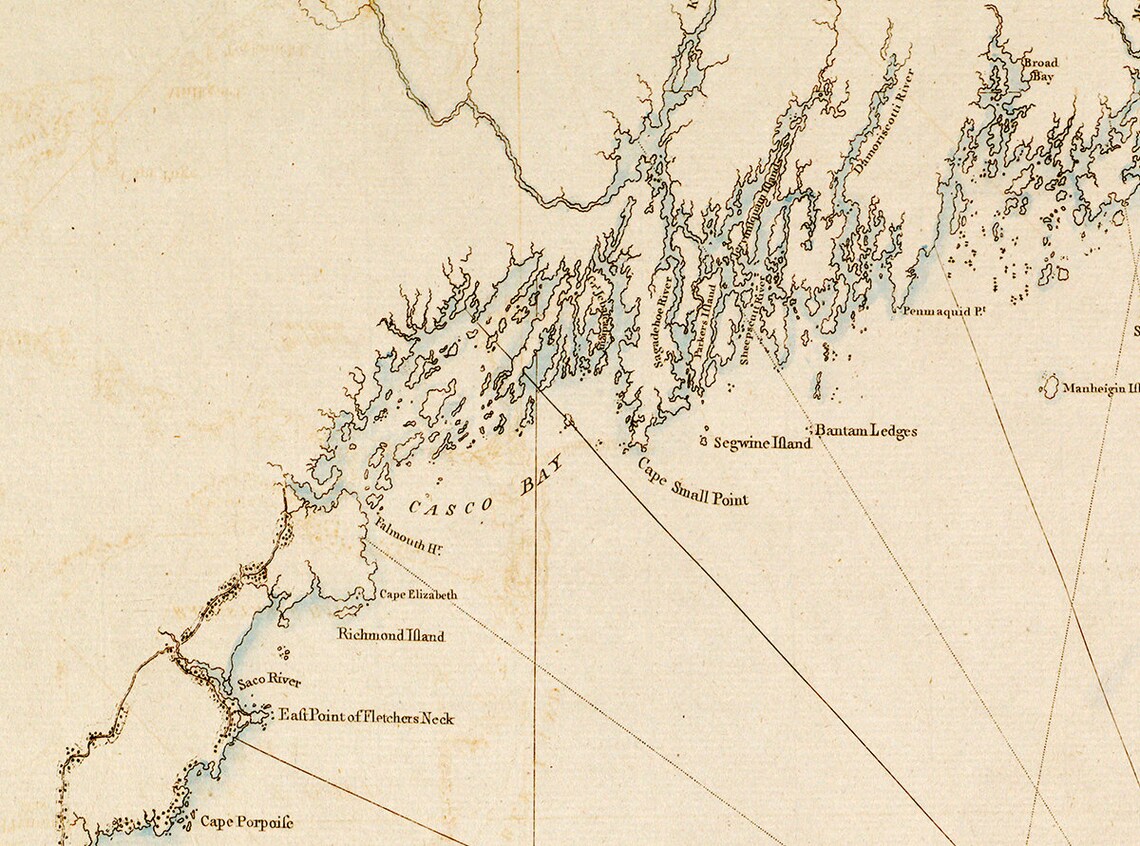
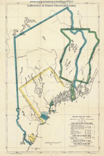
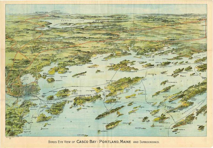
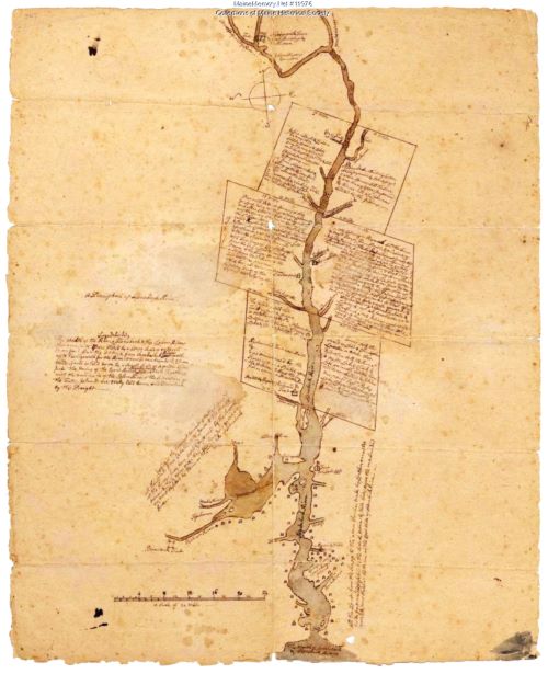
Illustration: Plan of the Kennebec River showing the Plymouth patent, ca. 1719. Maine Historical Society.

Bibliography:

Baker, E. W. (1986) Trouble to the eastward: the failure of Anglo-Indian relations in early Maine. Dissertations, Theses, and Masters Projects. William & Mary. Paper 1539623765. https://dx.doi.org/doi:10.21220/s2-mh0r-hx28

Baker, E. W. (1989) “A Scratch with a Bear’s Paw”: Anglo-Indian Land Deeds in Early Maine Ethnohistory 36 (3): 235-256

Early Settlement Period (2):  Wabanaki trade at Pemaquid

By the early 1630s, the sight of Wabanaki traders arriving in Pemaquid with their stocks of beaver, moose, and otter furs, pelts, skins, and hides was a common occurrence. Their periodic trading visits remained a part of local routine through the 1680s. Upon arrival, the traders did business with the several truck masters who operated trading posts or truck houses in the Pemaquid area.

Reconstructing the size of the Indian trading groups and the length of their stays is hampered by the usual dearth of historical documentation. The existing evidence suggests the Wabanaki typically traveled in small bands, consisting either of several adult males or small family units.  They probably remained in the Pemaquid area for anywhere from several days to several weeks.

“During their visits, the Indian trading parties probably stayed in several locations. One popular site appears to have been on the grounds of today’s Bristol Town Beach  … The beach area has added significance in that scholars believe it was the location of the Etchemin village visited by George Popham in 1607. A second possible Indian trading encampment may have also existed at the mouth of the Pemaquid River, but on its western banks, in a small cove just above the river’s Inner Harbor.20 While it has not been documented, some of the Indian visitors to Pemaquid likely spent time in the homes of local residents whom they had befriended or did business. Such a practice was not unusual in 17th-century New England. Period accounts contain numerous references to New Englanders taking in Indians for meals and overnight stays. Others probably established short-term trading camps on the more sparsely settled periphery of the Pemaquid plantation.”   (De Paoli, 2001, pp. 228-229)

By the 1630s, Maine traders had shifted from offering nicknacks such as mirrors, rings, and bells, to practical goods that supported the Amerindian’s changing needs, such as English cloth, foodstuffs, clay smoking pipes and tobacco, shot, powder, kettles, axes, liquor, and beads (DePaoli,1994).

In their transactions, the Amerindians were given credit to obtain materials ahead of time, and their debts were met when they brought furs back to the station. The amount of credit they were given depended on their reliability. The most successful traders dealt in quality goods, and if they cheated the Amerindians, they risked being killed. The longevity of Abraham Shurt’s twenty-five-year trading career at Pemaquid was a testament to his good reputation for being fair and honest.

“Shurt’s trading network included the Pilgrim’s bitter French rivals Charles D’Aulney at Pentagoet and Charles de la Tour at the mouth of the St.John River, the preeminent Acadian traders. He provided them with all kinds of provisions including powder and shot. His furs were shipped directly to England or Massachusetts Bay on the ocean-going vessels owned by Aldworth and Giles. These ships regularly shuttled between Bristol, Massachusetts Bay, and the mid-coast of Maine.

Boston’s John Winthrop was Pemaquid’s primary client. Pemaquid’s furs, hides, fish, wood products, and agricultural produce would have found a ready market in the region’s primary entrepot. With their sale, Shurt could clear old debts and replenish stocks of consumables for Pemaquid’s planters and Indian clients. Much the same was undoubtedly done, but on a smaller scale, with the merchants and traders from Massachusetts South and North shores, New Hampshire, and Maine who did business with the Pemaquid manager.” (DePaoli, 1994, pp. 178-179)

Samoset

From 1616 to 1653, the Sagamore of Pemaquid was Samoset, headquartered on Muscongus or Louds Island. He became a great friend of Shurt and aided the English settlers in many ways.

As a young man, Samoset interacted with English fishermen on Monhegan and learned to speak credible English. It was he who, in 1621, startled the Pilgrims by walking amongst them and talking to them in broken English, then later introducing them to Squanto and the great Wampanoag Sagamore, Massasoit. He explained that he was from Pemaquid, five days away by land and one day by water and rattled off the names of many captains and ships that had visited Monhegan.

Samoset would have a long, rich history of engagement with the English. He met and regaled Christopher Levett when he visited the region in 1623-1624. Levett described him as “a Sagamore, one that hath ben found very faithful to the English, and hath saved the lives of many, of our nation, some from starving, others from killing” (Baxter, 1893, p. 102). He was one of the Sagamores who deeded land to John Brown in 1625, and he would make several other smaller land grants to settlers in the 1630s and 40s. He cooperated fully with Abraham Shurt and was integral to his many Anglo-Indian negotiations.

Illustration: The cover of the 1853 book, Interview of Samoset with the Pilgrims, depicting Samoset meeting the Pilgrims.

Bibliography:

Baxter, J. P. (1893) Christopher Levett of York, pioneer of Casco Bay. Gorges Society, Portland.

DePaoli, N. (1994) Beaver, blankets, liquor, and politics. Pemaquid’s Fur Trade, 1614-1760. Maine History 33 (3): 166-201.  https://digitalcommons.library.umaine.edu/mainehistoryjournal/vol33/iss3/2

Early Settlement Period (3): Pemaquid becomes a Mid-Coast Trade Center

The Midcoast region of Maine is jagged and chaotic, with its rocky points resembling fingers plunging into the Atlantic Ocean. Nowhere is this more evident than at Pemaquid Point near Bristol, Maine. The Wabanaki had a name for this place, Pemi-Keag, which translates into “Extended or lengthened point.”

By the mid-1610s, West Country fishermen working for Sir Francis Popham were frequent visitors to the Pemaquid region and were actively trading with the Etchemin. After the Great Dying, there were no longer Etchemin encampments on the Pemaquid Peninsula, but groups of them traveled to the region from their remaining seasonal villages in the Kennebunk and Penobscot River drainages. 

Before the devastating plagues, the Pemaquid area had long played a prominent role in Etchemin history. As Neill De Paoli (2001, p.228) describes in his dissertation on early Pemaquid: “Archaeological evidence indicates that Native Americans fished, hunted, and traded on the Pemaquid mainland and offshore islands such as Monhegan for over four thousand years. Furthermore, the Pemaquid peninsula remained the site of an Indian canoe portage or carry while Anglo-Indian intercourse had roots that reached back to the first decade of the 17th century. Pemaquidians parlayed the plantation’s geographic advantages and the Maine’s Indians’ familiarity with the area into one of provincial Maine’s primary Anglo-Indian trade centers.”

One of the most active early year-round fishing communities was established on the eastern shore of the Pemaquid Peninsula at New Harbor by John Brown. As Williamson (1883, p. 66) reports:”In Levett’s explorations, when he reached Cape Newaggen, the locals told him that Pemaquid had been “granted” to Brown, who had obtained a patent, dated June 1, 1621, from the Plymouth Council, “allowing him the privilege of settling at any place he and his associates might choose, not however within ten miles of any other settlement.” He then obtained the first deed of a tract of land from the Wabanaki of Maine in July 1623

Grant of Aldsworth and Elbridge

On February 20, 1631, two Bristol merchants, Robert Aldsworth and Gyles Elbridge were awarded the last grant by the Council of New England, the Pemaquid Patent. It extended from the sea between Muscongus and Damariscotta rivers, so far north as to encompass 12,000 acres, plus 100 acres for every settler they brought over from England. It included the Damariscove Islands and all others within nine leagues of the shore. The proprietary grantees and their associates were to establish a civil government and were given “the right to hunt, fish, fowl, and trade with the natives in any part of New England.” 

Aldworth and Giles desired the patent to expand their growing mercantile empire in New England. They had already bought Monhegan from Abraham Jennings in 1626 and now sought to enlarge these interests by establishing a mainland operation.  They were undoubtedly encouraged to pursue this opportunity by Abraham Shurt, whom they had sent as their agent to purchase Monhegan and who was now a resident of Pemaquid. Also, the issuance of the Muscongus grant the preceding year likely pushed Aldworth and Elbridge to act or be left out.

This patent covered almost precisely the same ground John Brown had received in 1625 in his deed from the local Wabanaki, and by the time Aldsworth and Elbridge received their patent, there was already a year-round trading station at Pemaquid supporting about 80 people.

Golden Age of Pemaquid

Pemaquid steadily grew under the watchful eyes of its manager, Abraham Shurt. In the 1630s Pemaquid became the center of commercial activity on the whole Maine coast. English, French, and Wabanaki traders came together there, and its merchants sent fish, peltry, ship masts, barrel staves, livestock, and crops to the ports of England. Its domestic contacts included settlements scattered along French Acadia, Maine, New Hampshire, and Massachusetts Bay coasts.

One of the first additions was a series of wooden wharves to handle the upsurge in waterborne activity on the lower reaches of the Pemaquid mainland. The inhabitants constructed dwellings, storehouses, and miscellaneous outbuildings a short distance above the Pemaquid River and New Harbor shores. (De Paoli, 2001, p. 67)

The Pemaquid Plantation boomed throughout the 1630s. The community grew to encompass 150 to 200 people and served as the frontier on the northern fringe of English territory. It remained strong until the English Civil War began in 1642 and Eldridge died in 1643, with his finances in disarray. His  next two heirs, Robert and John died a few years after him, and the third, Thomas, moved to Pemaquid Plantation, “with little social standing and limited financial means” (DePaoli, 2001, p. 179).

Abraham Shurt stopped managing the Plantation around 1648 and moved to Charlestown, Massachusetts. Thomas Elbridge hired Francis Knight to manage the property from 1647 to 1650, when he began selling off his properties. He sold Monhegan and Damariscove to Richard Russell of Charlestown in 1650 and, in 1657, the whole patent to Massachusetts Bay merchant Nicholas Davison.

Illustration: J.F.W. Barres’ 1776 Nautical map of New England.

Bibliography

Burrage, H. S. (1914). The beginnings of colonial Maine 1602-1658. Marks Printing House.

DePaoli, N. (1994) Beaver, blankets, liquor, and politics. Pemaquid’s Fur Trade, 1614-1760. Maine History 33 (3): 166-201.  https://digitalcommons.library.umaine.edu/mainehistoryjournal/vol33/iss3/2

Parker, A. D. (1925) A history of Pemaquid with sketches of Monhegan, Popham and Castine.  MacDonald & Evans: Boston

Williamston, W. D. (1889) The history of the state of Maine: From its first discovery in A.D. 1602 to the separation, A.D. 1820, exclusive. Glazers, Masters, and Smith.

Early Settlement Period (4): Dixie Bull – Maine’s First Pirate

In 1632, New England’s first pirate, Dixey Bull, attacked and pillaged Pemaquid. Sailing audaciously into the harbor with three ships, he opened fire on the stockade and sacked the town. The booty was worth about £55, or today’s $2,500. While the plundering was going on, he was little resisted, but just as he weighed anchor, his second in command was shot to death from shore.

Born in Huntington, England, in about 1611, Dixey was trained as a skinner and apprenticed to his elder brother Seth for nine years. Skinners traded animal skins and furs. Dixey found his way to Boston in 1632 after being granted a land patent with his brother and a group of investors. He began his career in New England, sailing up and down the Maine coast in a small vessel, trading with the Wabanaki for furs, especially beaver. Before his rouge assault, Dixey had operated as a legitimate trader focusing mainly on Penobscot Bay. He was well-known to the Pilgram traders as an unwanted competitor.

Bull became a pirate after being attacked by a roving band of French thieves in Penobscot Bay, perhaps as part of a French force that had fallen upon the Pilgrim’s trading post in Castine Bay. Dixie’s ship was taken over, and all his trade goods and provisions were confiscated. He went to the Plymouth Company to plead for compensation but was spurned. Filled with rage, he returned to Boston, put together a crew of around 25 men, and began his career of piracy to recoup his losses. Ironically, he focused on English ships and settlements rather than French ones, even though the French attacked him. Perhaps English trading posts were wealthier.

After Bull’s raid on Pemaquid, the Pilgrim leader Winthrop dithered for a while but eventually sent out all the forces he could muster, four shallops and 40 men, to hunt down Dixie in what is considered America’s first armed naval expedition. Unfortunately, after two months of searching, the squadron returned empty-handed. Dixie got away, leaving a letter signifying his intent not to do any more harm to his countrymen and stating he and his crew were resolved to sink themselves rather than be taken.

Bull’s final fate is unknown. Some stories say he joined the French, others say he returned to England and took up work as a skinner, and still others suggest he was captured by government authorities and hanged in Tyburn, like other notorious pirates. There are also tales of his booty being buried on islands off the coast of Maine that were never recovered.

Dixie Bull’s legend was ultimately enshrined in ballads—the most famous being “The Slaying of Dixie Bull”:

“Dixey Bull was a pirate bold,

He swept our coast in search of gold.

One hundred years have passed away

Since he cast anchor in Bristol Bay.

Under the lea of Beaver’s shore

He laid his craft three days or more;

He flaunted his flag and shot his lead,

Which kept the people out of bed.

Until the folks of old Jamestown

Had passed the word to all around,

That Dixey Bull, the pirate bold,

Would not leave without their gold.

Into the fort the people came

To fight this man of bloody fame;

But well they knew the fort would fall

When stormed by powder and by ball.

Their gold was gathered in a pile

To send to him at Beaver’s Isle,

So the pirate would go his way

And leave the waters of Bristol Bay.

But Daniel Curtis, a fisherman,

Feared not the flag from which they ran,

But took his skiff; bent to his oar,

And rowed alone to Beaver’s shore.

‘I, Dan Curtis, my boat will pull

Down to the craft of Dixey Bull

And man to man, we’ll meet tonight,

To settle for all in a good, fair fight.

“And he who wins shall have the say

Of whether the riches go or stay;

If he kills me they’re his by right,

If I kill him we win the fight

The women wept, the children cried,

As he went off to the pirate’s side,

He gave a roar and waved his hand,

And said, ‘I want to see the man ”

The poem ends with Dixie being slain and saving the town.

IllustrationA pirate flag

Bibliography

 Eckstrorm, F.H. and Smyth, M. W. (1927)Minstrelsy of Maine: Folk-songs and Ballads of the Woods and the Coast. Boston: Houghton Mifflin.

Lagerbom, C. (2021) ‘Shiver me timbers?’ Maines first pirate. Midcoast Villager. https://knox.villiagesoup.com/opinion/shiver-me-timbers-maine-s-first pirate/article_9905e393-6681-5a3d-bebb-6214a00e82f8.html

Parker, A. D. (1925) A history of Pemaquid with sketches of Monhegan, Popham and Castine.  MacDonald & Evans: Boston

Early Settlement Period (5): Thomas Purchase builds an outpost at Pejepscot (Brunswick)

In 1628, about when the Pilgrims established their Kennebec trading post,  Thomas Purchase settled at Pejepscot (now Brunswick) and established a salmon fishery and trading post. Purchase had first landed in Maine at Saco with Richard Vines in 1626.

Burrage (1914, p. 242) suggests that “Doubtless after his arrival in the province, Purchase spent some time in seeking a favorable location for a settlement. From the eastern part of Casco Bay there was an Indian thoroughfare that led to the falls of the Pejepscot in what is now the town of Brunswick. Skirting the shores of Casco bay and journeying by this well-known route, Purchase probably reached the falls; or he may have made his way thither by the Sagadahoc to Merrymeeting Bay, and thence by the waters of the Pejepscot River. However this may be, by one route or the other, he discovered a very favorable location for trade with the Indians as they descended the river in passing from their villages to the mouth of the Sagadahoc or the pleasant camping grounds on the shores or islands of Casco Bay.”

On June 16, 1632 he and George Way received a formal patent to the land from the Council of New England. Wheeler and Wheeler (1878, pp. 789-790) suggest it encompassed “certain lands in New England called the river Bishopscotte [Pejepscot] and all that bounds and limits the mainland adjoining the river to the extent of two miles, from the said river northward four miles, and from the house there to the ocean sea with all other Profitts and Commodities whatsoever, paying to the King one fifth part of gold and silver oare, and another fifth part to the President and Council, also paying twelve pence to the said President and Councill for every hundred Acres of Ground in use, to the rent-gatherer for the time being, as by the same Grant may appeare.

There is no record of George Way coming to New England, although it is known that his widow and sons ultimately resided in Hartford, Connecticut.

Purchase would make his living in a myriad of ways. “During his residence at Pejepscot he was probably engaged in different pursuits at different times. He is mentioned as a hunter and trader with the Indians, as being engaged in the salmon fishery, and as a planter. The causes that led to his emigration can never be known, but there is every reason for supposing that he came to Pejepscot in pursuit of furs and peltry,’ which he acquired partly by his own exertions in the chase and partly by traffic with the natives. He was also engaged for the whole period of his residence in obtaining salmon and sturgeon and packing them for exportation to London and probably collected a number of settlers near him. He also cultivated the soil, and at the time of the attack upon his house by the Indians in 1676, he was possessed of stock and probably had what in those days would be considered a respectable farm.” (Wheeler and Wheeler, 1878, p. 793).

Purchase’s diverse enterprises required the services of many helpers, and many of the new emigrants now making their way to Maine came to work for him. Purchase came to support a bustling little community. He became well-known and was considered one of Maine’s most prominent men.

In 1639, Purchase contacted John Winthrop, governor of Massachusetts Bay, and asked to be placed under the jurisdiction of that colony. He deemed this prudent, even though he had his patent from Gorges, as there was no effective government in the part of Maine he had settled. Burrage (1914, p. 304) suggested that “Purchase deemed it imperative to make an effort in some direction, and he made his appeal to the governor of the colony of Massachusetts Bay. Winthrop evidently listened sympathetically to a description of conditions among the settlers along the Androscoggin River, and as a result of the interview, by an indenture executed August 22, 1639, Purchase conveyed “to John Winthrop and his successors, the governor and company of the Massachusetts forever, all that tract of land at Pejepscot upon both sides of the river of Androscoggin, being four miles square towards the sea, with all liberties and privileges thereunto belonging”. The right to plant there “an English colony” was included in the rights conveyed, as also “full power forever to exercise jurisdiction there as they have in the Massachusetts” ; while Purchase, his heirs and assignees, together with all other inhabitants within the limits of the Pejepscot grant, were to be given that “due protection of the said governor and company” as was enjoyed by the inhabitants of the Bay colony.

Purchase lived long and well in Maine. When he first arrived at Pejepscot, he was 53 years old. He died in 1678 at the age of 101.

Illustration: Woodcut, Unknown Artist, White Traders bartering with Indians. Originally from: Graphic Arts Collection, National Museum of American History, Smithsonian Institution, Nr: 2003-33644

Bibliography:

Burrage, H. S. (1914). The beginnings of colonial Maine 1602-1658. Marks Printing House.

Wheeler, G. A. and Wheeler, H. W. (1878) History of Brunswick, Topsham, and Harpswell, Maine, including the ancient territory known as Pejepscot. Alfred Mudge & Son, Printers.

Early Settlement Period (6): Ferdinando Gorges and the Council of New England

In 1620, Sir Ferdinando Gorges convinced James I to establish a charter, Laconia, to settle New England between the 40th and 48th parallels. The charter was awarded to a group of 40 mostly gentry investors from Plymouth, Exeter, and Bristol, who called themselves “The Council of New England in America.” 

The patent bestowed upon them not only the authority to establish, rule, and govern the vast territory but also gave them an extensive array of additional rights and privileges. “They were granted ownership of the firm lands, soils, grounds, havens, ports, rivers, waters, fishings, mines and minerals, as well as royal mines of gold and silver, or other mine and minerals, precious stones, quarries and all, and singular other commodities, jurisdictions, royalties, privileges, franchises and pre-eminencies, both within the same tract of land upon the main and also within the said islands and seas adjoining.” (Farnham, 1901, p. 33).

The patent also stipulated that no other of the king’s subjects could enter and visit any of the ports of New England in America, or trade or traffic therein, without a license from the council for New England, under the penalty of the forfeiture of both ships and goods.

Remarkably, the document justified the colonization of New England by suggesting that God had recently emptied the region of Indigenous people by plague and warfare – the Wabanaki, who had lived on the land for more than 12,000 years.  

As stated in the patent:  “We have been further given certainly to knowe, that within these late Yeares there hath by God’s Visitation reigned a wonderfull Plague, together with many horrible Slaugthers, and Murthers, committed amoungst the Sauages and brutish People here, heertofore inhabiting, in a Manner to the utter Destruction, Devastation, and Depopulation of that whole Territorye, so that there is not left for many Leagues together in a Manner, any that doe claime or challenge any Kind of Interests therein, nor any other Superiour Lord or Souveraigne to make Claime “hereunto, whereby We in our Judgment are persuaded and satisfied that the appointed Time is come in which Almighty God in his great Goodness and Bountie towards Us and our People, hath thought fitt and determined, that those large and goodly Territoryes, deserted s it were by their naturall Inhabitants, should be possessed and enjoyed by such of our Subjects and People as heertofore have and hereafter shall by his Mercie and Favour, and by his Powerfull Arme, be directed and conducted thither. (Farnham, 1901)

Plymouth is settled in the wrong place

On 11 November 1620, a group of Pilgrims landed and settled smack dab in the center of the Council’s newly awarded territory. The Pilgrims had a charter from the Virginia Company, allowing them to settle south of Cape Cod, but weather conditions and a difficult tide had forced them to anchor at Provincetown Harbor in Massachusetts, well north of their intended destination. Knowing full well that they were in a region outside the jurisdiction of the Virginia Company,  the Pilgrims formed the Mayflower Compact to provide a semblance of law and order in the new colony until a new patent could be obtained from the Council of New England.

When the first news from the colonists got back to England, the stockholders in the Plymouth Plantation led by John Peirce went to the Council of New England to get the Pilgrims the rights to live and establish a government where they had landed (Baker, 2007). Most of the records of the Council before 1622 are lost, but the text of what became known as the Peirce Patent survived. Like their first patent, the Peirce Patent gave the Pilgrims seven years to establish a settlement successfully. If the settlement was successful at the end of seven years,  a new “permanent” patent would be issued; if the settlement was unsuccessful, then all rights would revert to the Council.  The patent further stipulated that the settlement would initially receive a total of 1500 acres and 100 acres for every person who moved there and stayed for three years or died in the attempt. The settlers were made responsible for developing their own local government, making laws, and governing themselves. 

Other early Council Decisions

In its first years, the Council of New England struggled mightily to make decisions on the division of its land. Several proposals were made but never consummated, except for the Plymouth colony request.  Finally, on August 10, 1622, the Council decided to play large and grant all of today’s Maine and New Hampshire to Sir Ferdinando Gorges and Captain John Mason. They were awarded “all that part of the mainland in New England lying upon the sea coast betwixt the rivers of Merimack and Sagadahock and to the furthermost heads of the said rivers and so forward up into the new land westward until three score miles be finished from the first entrance of the aforesaid rivers and half way over, that is to say to the midst of the said two rivers . . . . . . said portions of lands with the appurtenances the said Sir Ferdinando Gorges and Captain John Mason, with the consent of the resident and council, intend to name the Province of Maine.” (Burrage, 1914, p. 167)

This is the first use of the designation Province of Maine in any printed document. It was later divided into the Provinces of Maine and New Hampshire in 1629 by Mason and Gorges.

Illustration: The 1622 grant of the Province of Maine. The later division into the Province of New Hampshire and the Province of Maine is shown by shading. © 2004 Matthew Trump.

Literature cited:

Baker, P. M. (2007) The Plymouth Colony patent: Setting the stage. Pilgrim Hall Museum. https://pilgrimhall.org/pdf/The_Plymouth_Colony_Patent.pdf

Burrage, H. S. (1914). The beginnings of colonial Maine 1602-1658. Marks Printing House.

Farnham, M. S. (1901) History of the state of Maine. Vol. VII. The Farnham Papers, 1603 – 1688. The Thurston Print, Portland.

Williamston (1889) The history of the state of Maine: From its first discovery in A. D. 1602 to the separation, A. D. 1820, exclusive. Glazers, Masters, and Smith.

Early settlement Period (7): Sir Ferdinando’s Grand Plan

In 1622, Ferdinando Gorges,  a naval commander and governor of the important port of Plymouth in England, sought and received a grant for a massive piece of New England from King James I, called the “Province of Maine.” For the next 25 years, Gorges spent much of his time and money trying to develop this English colony. He would gain the title of the “Father of English Colonization in North America,” but his success in settling Maine would greatly pale compared to that of the Puritans in Massachusetts.   

Gorges would try to settle Maine using a model distinctively different from the other English colonies at Jamestown and Plymouth. As Burrage (1919, p. 175) described: “There was no organization like that which planted the colony at Jamestown in Virginia, or … even as it was with the Pilgrims at Plymouth – a body of men and women who, not finding in the old world those conditions of civil and religious liberty under which they desired to live, sought such conditions in the new world, and associated themselves together for this purpose. Here, even formal association preliminary to such beginnings was lacking, and only individual enterprise, pure and simple, is discoverable.

The colonies settled west of Cape Ann, such as Plymouth and Massachusetts Bay, were set up as communities of families with representative governments and individual rights. Gorges’ model envisioned colonies with a more or less feudal owner under an appointed governor loyal to the English King.  The settlements east of Cape Ann were owned by investors who expected an annual profit; the settlements to the west of Cape Ann were supported by loans from investors that were to be paid back. This dichotomy in settlement strategies is unsurprising, as Gorges was a royalist supported by the King, while Massachusetts was settled by Puritans seeking liberty.

To govern his territory, Gorges planned a complex structure fit for an empire. It would be comprised of eight bailiwicks divided into sixteen “several hundreds.” The colony would be administered by officers such as a chancellor, a treasurer, a marshal, an admiral, a master of the ordnance, and a secretary for the public service.

“This grand scheme never came to fruition, for while Gorges theoretically controlled English access to who did what and where in Maine, His authority faced significant challenges. Independent English hunters and fishermen had been harvesting the area for decades, and they constantly engaged in the “promiscuous trading” Gorges and other organized interests found so objectionable. Moreover, members of Plymouth Colony, which had been founded with fewer than sixty inhabitants but had rapidly become more successful than any of Gorges’ own attempts at settlement, had begun to encroach on the territory that Gorges and Mason had claimed. By 1625 Plymouth settlers were sailing many miles up the Kennebec River-Plymouth’s eastern border, which divided it from Maine, -to trade their com with Indians in exchange for furs that were almost certainly procured within Maine’s borders.” (Farber, 2009, p.492)

Sir Ferdinando’s grand scheme also suffered from the Council of New England issuing a haphazard array of patents that defied order. During the 1630s and 1640s, various individuals, companies, and political factions struggled to gain control of the territory of New England, but their efforts lacked coordination. English rulers granted land patents with vaguely defined or overlapping borders. Colonies competed for natural resources with one another and with independent settlers, fishermen, and traders who engaged, as the speculator Sir Ferdinando Gorges wrote, in “promiscuous trading without order and in a disjointed manner.” Plantations were chartered and abandoned; patents were granted and canceled; and provinces the size of kingdoms rose and vanished within a matter of years. (Farber, 2009, pg. 409)

The Puritan model of colonization was far more successful than that of Gorges. By 1640, migration had swelled the English population of Massachusetts to over 20,000, while Maine’s had stagnated at a few thousand. In the 1650s, Massachusetts Bay absorbed most of Gorges’s colonies in western Maine, and in 1677, Sir Ferdinando’s heir sold the remainder of his empire to the state of Massachusetts for £1,250.

Illustration: The charters in Maine awarded by Sir Ferdinando Gorges and the Council of New England.

Bibliography:

Burrage, H. S. (1914). The beginnings of colonial Maine 1602-1658. Marks Printing House.

Farber, H. (2009) The rise and fall of the Province of Lygonia, 1643-1658. The New England Quarterly 82: 490-513

Early Settlement Period (8): Monhegan Island – The Cradle of New England

Monhegan Island, a unique landmass nestled twelve nautical miles into the Gulf of Maine, may appear diminutive at 4.5 square miles, 1.75 miles long, and 0.75 miles wide. However, its historical significance is far from small. This unassuming island played a surprisingly pivotal role in the European discovery of New England.   

Bartholomew Goswald, a true pioneer, was the first European explorer to venture into the Gulf of Maine, landing on the coast at Cape Elizabeth or nearby in 1602. The first explorer to step foot on Monhegan was likely Martin Pring in 1603, on his way to the Pamet River on Cape Cod to harvest what was believed to be a wonder drug – sassafras. Regrettably, he left no specific record of his stay on Monhegan.

The second explorer to land on Monhegan, was George Waymouth, in the Archangel, on May 17, 1605. As his chronicler, James Rosier vividly describes:  “… at about sixe a clocke at night we descried the land, which bare from vs North-North-East; but because it blew a great gale of winde, the sea very high and neere night, not fit to come upon an unknowen coast, we stood off till two a clocke in the morning, being Saturday; then standing in with it againe, we descried it by eight a clocke in the morning bearing North-East from us.  It appeared a meane high land, as we after found it, being but an Iland of some six miles in compasse, but I hope the most fortunate euer yet discoured.  About twelve a clocke that day, we came to an anker on the North side of this Iland, about a legue from the shore.  About two a clocke our Captaine with twelue men rowed in his ship boat to the shore, where we made no long stay, but laded our boat with dry wood of olde trees upon the shore-side and returned to our ship, where we rode that night.”

Rosier further describes: “This Iland is woody, grouen with Firre, Birch, Oke, and Beech, as farre as we saw along the shore; and so likely to be within. On the verge grow Gooseberries, Strawberries, Wild pease, and Wild rose bushes. The water issued forth down the Rocky cliffes in many places: and much fowl of divers kinds breed upon the shore and rocks. While we were at shore, our men aboord with a few hooks got aboue thirty great Cods and Hadocks, which gaue us a taste of the great plenty of fish which we found afterward wheresoeuer we went vpon the coast.” (Winship, 1905, p. 106)

Rosier recognized they had come upon a cod fishery superior to Newfoundland’s well-known coast. He reported that “in a short voyage [a] few good fishers [could] . . . make a more profitable returne from hence than from Newfoundland: the fishing being so much greater, better fed, and abundant with traine [train-oil]; of which some they desired and did bring into England to bestow among their friends, and to testifie the true report.”

This discovery of a great cod fishery would turn Monhegan into a beehive of activity, making it one of New England’s most important stops for about 30 years. Captain John Smith, of Jamestown fame, was sent to Monhegan in 1614 by Ferdinando Gorges, Governor of the port of Plymouth in England. He was told to hunt whales for oil and search for gold and copper mines, but fish and furs would be the backup if these endeavors failed. It was the backup that proved most profitable. As Smith related in his 1616 book, A Description of New EnglandWe found this Whalefishing a costly conclusion – we saw many, and spent much time in chasing them; but could not kill any … For our gold, it was rather the Master’s device to get a voyage that projected it, than any knowledge he had at all of such a matter. Fish and Furs was now our guard ….”

Smith described Monhegan Island as a “round, high Ile, and close by it [is] Monanis betwixt, which is a small harbor where we ride.” He stated, “I made a garden upon the top of a Rockie Ile in 43 ½, 4 leagues from the Main, in May, that grew so well, as it served us for sallets in June and July. From Monhegan, Smith made an exploring trip along the coast of what he coined  “New England,” leaving his companions to fish.

By the time of Smith’s arrival, Monhegan’s harbor must have been a busy place. He wrote in his Description that in  1615, “foure good shippes” came and in 1616, four more ships sailed from London, and four from Plymouth. Smith also describes that in 1620, “six or seuen sayle from the west Countrey onely to fish.” In Smith’s “New England’s Trials,” published in 1622, he declares “the successe of 80 Ships employed thither within these eight years”.

In the mid-1620s, year-round fishing stations spread out from Monhegan all along the coast of New England. The first was at Damariscove, followed by Cape Newagen, Piscataqua, Pemaquid, and Richmond Island.

Cod fishing, which began at Monhegan, was New England’s first major economic activity.

IllustrationMonhegan, Maine (1922) by Nicholas Roerich (Google Art Project)

Bibliography

Arber, E. (Ed.) (1910) Travels and works of Captain John Smith. John Grant, Edinburgh.

Churchill, E. A. (1978) The Founding of Maine, 1600-1640: A Revisionist Interpretation. Maine History 18 (1): 21-54  

Jenny, C. F. (1921) The fortunate island of Monhegan: A historical monograph. Proceedings of the American Antiquarian Society (pp. 299 – 357).

Smith, J. (1865) [1615] A Description of New England or Observations and Discoveries in the North of America in the Year of our Lord, 1615. William Veazie.

Winship, G. P. (1905) Sailors Narratives of Voyages Along the New England Coast, 1524-1624. Houghton-Mifflin & Co., Boston

Early Settlement Period (9): First Fishing Stations

The first Europeans to fish in the Gulf of Maine did not come from the West of England, as is often portrayed, but rather from Jamestown, Virginia. Virginian fishing crews likely began visiting the coast of Maine soon after the colony’s 1607 establishment. By 1613, French priest and observer Father Biard noted that the Virginians were sailing north  “every summer” to the offshore islands in the vicinity of Pemaquid. He was undoubtedly referring to the islands of Monhegan and Damariscove. The Virginians likely dominated fishing in the area from 1608 to 1614 and continued until around 1625. Their ships brought back a vital source of food for the winter months.

It wasn’t until the mid-1610s that the fishermen from the West of England began to arrive, along with a few French vessels. The fisherman from the West of England came for purely commercial reasons. The cod they caught were destined for the markets of France, Spain, Portugal, and Italy. Their numbers grew as word spread within England’s fishing and merchant communities of the productivity of New England coastal waters. In 1614, English merchants sent four fishing vessels to New England. Six years later, that number had grown to six or seven. The majority of the vessels congregated in and around the waters of the Isles of Shoals, Monhegan, Damariscove, and Copenhagen.

The number of fishermen in the Gulf of Maine fell far short of the numbers traveling to Newfoundland, but the New England Industry steady grew. By 1622, thirty-seven English fishing boats made the journey across the ocean to the coast of Maine. They were joined by the first inhabitants of the Plymouth plantation beginning in 1621, who sent one or two boats a year. During the early 1620s, Plymouth suffered many food shortages due to poor harvests, and these resources proved critical to their survival.

The actual settlement of Maine began mainly as an offshoot of fishing, with the formation of permanent fishing stations.  In 1623, Sir Ferdinando Gorges established the first year-round English fishing communities on the Damariscove and Monhegan Islands. Another was soon established at Odiorne Point, New Hampshire, and others at Cape Newagan and Richmond Island, Maine

One of the most active early year-round fishing communities was founded by John Brown at New Harbor on the eastern shore of the Pemaquid Peninsula. Pemaquid had been “granted” to Brown, on June 1, 1621, by the Plymouth Council, “allowing him the privilege of settling at any place he and his associates might choose, not however within ten miles of any other settlement”( Williamston, 1883, p. 66 ). He obtained the first deed of a tract of land from the Wabanaki of Maine in July 1623. 

Burrage (1914, p. 200) suggested that: “The proclamation of the king, calling attention to England’s interests on this side of the sea, gave an added impulse to English settlements on the Maine coast. Pemaquid began to develop into a prosperous community. By 1630, no less than eighty-four families had located there, on the St. George’ River and at Sheepscot. The first fort at Pemaquid, was likely erected about this time,  probably not so much as a defense against Wabanaki assaults as against outlaws and plunderers of French descent.

Resident fisheries began to pop up east and west of Cape Ann between 1620 and 1640. In the east early fisheries were established at Monhegan, Damariscove, Pemaquid, Glouchester, Odiorne Point, Cape Newagen and Richmond Island.  These fishermen were mainly from the West Country of England, and they were not particularly religious men; they came to fish (Leavenworth, 2008). The exceptions were at Pemaquid and Glouchester, which the Puritans had established themselves from Plymouth. Southwest of Cape Ann, Puritans from the Massachusetts Bay Charter at Salem established fishing settlements all down the northwestern shore of Massachusetts Bay from Salem to Hull, south of Boston.

These New England fisheries had an enormous advantage over those in Newfoundland, as the milder New England climate could support European modes of agriculture. “Fishermen who arrived for a resident fishery as company employees soon discovered they could walk away from the operation and not only survive but prosper. They could acquire land for a house and garden simply by squatting or by arranging a lease under one of the Proprietor’s local agents. Year-round squatters could farm when not fishing, making themselves relatively independent of European food supplies”. (Leavenworth, 2008, p. 37).

Illustration: Processing cod for transport. Original picture source unknown.

Bibliography:

Burrage, H. S. (1914). The beginnings of colonial Maine 1602-1658. Marks Printing House.

De Paoli, N. (2001) Life on the edge: Community and trade on the Anglo-American periphery, Pemaquid, Maine, 1610—1689. Doctoral Dissertations. University of New Hampshire Scholars Repository. https://scholars.unh.edu/dissertation/11

Harrington, F.  (1995) Wee Tooke Great Store of Codfish, In: Baker, E. (Ed.)   American Beginnings: Exploration, Culture, and Cartography in the Land of Norumbega.University of Nebraska Press, pp. 198–201.

Leavenworth, W. (2008) The changing landscape of maritime resources in seventeenth-century New England. International Journal of Maritime History  20: 33-62.

Smith, J. (1865) [1615] A Description of New England or Observations and Discoveries in the North of America in the Year of our Lord, 1615. William Veazie.

Williamston (1889) The history of the state of Maine: From its first discovery in A. D. 1602 to the separation, A. D. 1820, exclusive. Glazers, Masters, and Smith.

Early Settlement Period (10): Life on a 17th-century fishing station, Richmond Island, Casco Bay

On December 1, 1631, the English merchants Robert Trelawny and Moses Goodyear were deeded from the Council of New England a tract of land between the Spurwink and Presumpscot Rivers along Casco Bay, “with liberty to erect and maintain stages and places for preserving fish in and upon and near the islands commonly called Richmond” (Burrage, 1914, pp. 213-214)

The next year, they sent an agent named John Winter to establish a settlement on Richmond Island, where the workers would be employed in several occupations, including lumbering, fishing, trading, and shipbuilding. The Trelaway papers, a compilation of letters, accounts, and documents sent by Winter to Trelaway over a ten-year period, detail this operation (Baxter, 1844). 

In its prime, the station was large, with at least 60 fishermen on the island, a few artisans and servants, and several yeomen who farmed at nearby Spurwink. Very few women were on the island except for Winter’s wife. The workers were hired for three years and were paid annual wages, a share of the catch, or a combination of both.

“The fishermen worked in crews of four, three of whom went to sea, while the fourth remained at the island, curing the fish previously brought in and preparing it for shipment to Europe. The sea-going men included a master, who steered the vessel and was in charge of the voyage, and a midshipman and fore-shipman responsible for handling the craft. They fished from shallops, double-ended vessels about twenty feet long and measuring three to five tons” (Churchill, 1984, p. 186)

The men generally made three or more day-long fishing trips each week during the winter; in the summer, when fishing was poor, they might extend their trips to two days. They could only stay out to sea for so long before the fish began to spoil. These trips could become quite dangerous if a sudden squall or a severe cold snap came up.

In the summer, the station yeoman managed about 20 acres of crops and a substantial herd of cattle, goats, and pigs. In the winter, they helped dress and dry fish.

Treleway sent several ships each year to England, Spain, or France, loaded with fish and whale oil. The ships returned with manufactured goods and provisions.

About the only leisure time the men got was to sleep and eat. The pattern for serving meals—light breakfasts and lunches and a major meal at suppertime—was set to correspond with the fishing schedule. Typical meals included breakfast of cornbread, flat cakes, and beer; for lunch, biscuits, pork or cod, and wine for the fishermen; and bread, perhaps a light gruel, and drink for the shoremen. Supper often consisted of a stew, pork, peas, bread, pudding, and beer or wine.

“Alcoholic drinks, for Winter’s men as for most people in the New World, England, and Europe, were staple beverages. Any man who had to drink water was felt to be truly deprived, and it was thought to be positively harmful to do so for any length of time. Beer, the basic drink, was brewed on the island from barley, wheat, and other grains, locally grown hops, and imported malts. Wines and brandies had to be imported, though, and apparently, each man was required to purchase his share of these more potent beverages.” (Churchill, 1984, pp. 192 -193).

The men at Richmond Island regularly attended religious services. In 1636, Trelaway sent the Reverend Richard Gibson, an Anglican clergyman, to the station on a three-year contract. In 1642, Mr. Robert Jordan, a clergyman of the Church of England, moved to the island and began regular services.

Most of the men Winter hired came from small towns in Cornwall and Devon Counties in the West Country of England. Most were in their 20s, and a little more than half were married and sent part of their wages home. Many stayed in Maine after their term of service. Out of 110 who finished their term, it is known that at least 33 remained in Maine, and 11 or 12 moved somewhere else in New England (Churchill, 1984). Among those that stayed, many became independent fishermen and farmers scattered along the coast.

Some of the men who remained in Maine after their service did very well financially. “Landman Jonas Bailey, for example, managed to save about half of the £5 he earned each year at Richmond Island and was able to move to nearby Blue Point. He settled down and soon married the widow of a local landowner, carpenter George Deering. And thereby acquired all of Deering’s holdings. Bailey operated the farm until he died in the winter of 1664. He left an estate valued at £290, including his farm, a herd of twenty cattle, seventeen hogs, a substantial stock of provisions, and an impressive list of household items.

Another enterprising laborer from the Island, Richard Martin, would also accumulate an estate of more than £200. In 1639, only two years after arriving at the Island and while still engaged by Winter as a fisherman, he had raised enough hogs independently to sell over 560 pounds of meat to his employer. He started a farm at Scarborough but moved to Presumpscot after marrying widow Atwell and acquiring her holdings. He developed and expanded his agricultural operation, bought and sold land, and even worked a second stint with Winter in the early 1640s. The inventory of his estate in 1672/3, like Bailey’s, mirrored his farming activities” (Churchill, 1984, pp. 201 – 202)

Illustration: Cod fishing shallop. Canadian Museum of History.  https://www.historymuseum.ca/cmc/exhibitions/hist/lifelines/licog18e.html

Literature cited:

Baxter, J. P. (ed.) (1844) The Trelaway papers. Hoyt, Fogg and Donham, Portland.

Burrage, H. S. (1914). The beginnings of colonial Maine 1602-1658. Marks Printing House.

Churchill, E. A. (1984) A most ordinary lot of men: The fisherman at Richmond Island. Maine in the early Seventeenth century. The New England Quarterly 57: 184 – 204.

Early Settlement Period (11): Saco and Biddeford

Two of the earliest patents awarded by the Council of New England were along the Saco River in Maine in 1630. One was given to John Oldham and Richard Vines, covering the area between Cape Elizabeth and Cape Porpoise on the south side of the river (now occupied by Biddeford), and the other to Thomas Lewis and Richard Bonython on the north side of the river (today represented by Saco).

The area covered by these grants was well-known to European explorers. Previous visitors were Samuel de Champlain, who had arrived at Saco Bay in 1605 and described a large community of agricultural people farming along the Saco River, and Richard Vines himself, who had spent the winter of 1616-1617 at a place he called Winter Harbor, a protected area at the mouth of the Saco River. He had been sent by Ferdinando Gorges to test the survivability of the Maine winter and had spent it in the wigwams of Wabanaki, who by that time were so sorely afflicted with a plague “that the country was in a manner left void of inhabitants (Baxter, 1885, p. 19).

Vines took possession of his patent on June 5, 1630, in a ceremony witnessed by several fellow travelers and explorers. Included in that group were Edward Hilton and Thomas Wiggen of Pascataqua (today Piscataqua),  Isaac Allerton, a prominent member of the Plymouth colony, and Thomas Purchase, who would later establish a trading post at Pejepscot, now Brunswick.  

Vines established his colony near the mouth of the river in the area that would become the village of Biddeford Pool, the same place he had spent the winter of 1616-1617 (Folsom, 1830). During the early years of his colony, about 40 people came to settle with him. Bonython, his son John, and two daughters emigrated to Biddeford in 1630 or 1631, and were joined by about 50 others.

The colonists found the land largely uninhabited, with vast stretches of abandoned agricultural fields. Vines was assigned as the area’s governor, while Bonython would serve as his assistant. Brighton, another early settler who had been a military officer in England, was made a magistrate. For the next century, the name Saco would be used to represent both settlements on the two sides of the river.

Most settlers engaged in farming, fishing, or both and traded for furs with a small group of local Wabanaki that had summer camps in the Saco area (Folsom, 1830). Most Europeans pursued all these activities and referred to themselves as husbandmen or planters. Most of the husbandmen took leases on 100 acres, which they rented for small fees from Vines.

The settlements along the Saco were small but soon had a vigorous economy. As described by Folsom (1830, pp. 36 – 37): “Fishing was the most common occupation, as it was both easy and profitable to barter the products of this business for corn from Virginia, and other stores from England. The trade with the planters of Massachusetts soon became considerable … The fishermen take yearly on the coast many hundred quintals of cod, hake, haddock, pollock, etc. and dry them at their stages, making three voyages in a year. They make merchantable and refuse fish, which they sell to Massachusetts merchants …  The merchant sends the first to Lisbon, Bilboa, Marseilles, Bordeaux, Toulon, and other cities of France; to Canaries pipe staves and clapboards: the refuse fish to the W. Indies for the negroes …

A considerable traffic was carried on with the natives by many of the planters, some of them visiting remote parts of the coast, or travelling into the interior for this purpose. English and French goods were bartered for valuable furs, particularly beaver … The furs obtained in the trade with the natives were disposed of to the European vessels that frequented the coast or at some of the few trading houses established in this quarter by the western colonies and English merchants. The greatest resort in our vicinity for these objects, at the period referred to, was Richmond’s island, now a part of the town of Cape Elizabeth.”

The colonist’s interactions with the local Wabanaki were uneasy at best. From the colony’s beginning, the settlers would be “strangers” and the Amerindians “savages”. The Wabanaki’s numbers were far lower than they had been when Champlain first visited, but the settler’s farms and fishing still encroached on native hunting and fishing grounds, interfering with the Wabanaki’s time-honored activities.

There was one particularly ugly incident between the traders and Wabanaki. Winthrop reported that a man named Jenkins, in I632, traveled from Cape Porpoise into the country, where he was killed, and his goods stolen while he was sleeping in a wigwam.  The local chief recovered the goods and sent them back (Folsom, 1830).   

Illustration: Woodcut, Unknown artist, White traders bartering with Indians circa 1820. Graphic Arts Collection, National Museum of American History, Smithsonian Institution, Nr: 2003-33644

Bibliography:

Baxter, J. P. (1885) George Cleeve of Casco Bay 1630-1669, with collateral documents. Gorges Society

Folson, G. (1830) History of Saco and Biddeford, with notices of other early settlements and of the proprietary governments, in Maine, including the provinces of New Somersetshire and Lygonia. Alex G. Putnam.

Early Settlement Period (12): Agamenticus (York)

At about the same time that the Saco River Valley was being settled, Agamenticus, to its east, was also colonized. This colony would become the focus of Sir Ferdinando’s efforts to govern Maine.

The first person to settle at Agamenticus was Edward Godfrey, who arrived around 1630 as a squatter at age 45. Born in 1584, he had been a factor in Sicily, Egypt, and Venice in the 1610s. In the 1620s, he worked as an assessor for Wilmington and was one of the investors in the Plymouth Colony.

Godfrey’s decision to migrate to New England was undoubtedly influenced by adventurer Christopher Levett’s journal,  “A Voyage Made into New England,” published in 1628.  “Godfrey was an omnivorous collector of books and maps of the New World, and it is not too much of an assumption that Godfrey then read in this volume Levett’s opinion of the “great river called Aguamenticus” where he thought “a good plantation may be settled for there is a good harbor for ships, good ground and much already cleared fit for the planting of corne and other fruits.” There it lay ready for the taking, and, as it happened, this was where Edward Godfrey staked his claim. (Banks, 1931, pp. 47-48)

Godfrey sailed for New England in 1629, with the destination of Piscataqua, and arrived there on November 17 with his nephew John, an eleven-year-old youth.  He may also have traveled with Col. Walter Norton, “scion of a family of wealth and distinction in the official and mercantile circles of England” (Banks, 1931, p. 85), who would later become his townsman. Godfrey spent a little time in Piscataqua but soon headed to Agamenticus on a fishing boat.

The founder of Agamenticus built his house on a tongue of land at a place he called Point Bollyne, likely inspired by his ancestor Godfrey of Bologne. His house was: “undoubtedly a rough log cabin … with glazed windows, brick chimney, plastered walls, and ceilings … The axe and adze hewed down and faced the felled timber for the walls, and the roof was probably thatched over a framework of saplings or small hand-sawn logs.  Carpenters from the settlement at Piscataqua must have done the actual work of construction, for Godfrey himself was not an artisan. His previous occupation as a merchant scarcely fitted him for the part of a traditional pioneer. Clay dug from the banks nearby, or from the tidal flats, was daubed into the chinks between the logs to keep out the wind and rain, while oiled paper served as the translucent film in substitution for glass in the rough window frames. For a chimney and fireplace we cannot conceive anything more elaborate than one built of flat field stones held together, perhaps, by cement, or more likely by smoked-baked clay. Imagination does not give us much encouragement in trying to depict the interior furnishings” (Banks, 1931, p. 45)

Walter Norton soon followed Godfrey to Agamenticus. He had first settled in Massachusetts Bay, but being an Episcopalian and Royalist, he did not fit in well with the Puritans, so he left, heading to Piscataqua and then Agamenticus.  “Godfrey, in the eagerness which characterized all his work in Maine, must have taken Norton to the beautiful river of Agamenticus, where he had recently settled, and shown to this seasoned adventurer the great forests and rolling meadows bordering its banks. To his astonishment, the vision of a virgin country of unknown wealth was laid before him, with its thousands of untilled acres, to be had for the asking, at the pleasure of the Council for New England.” (Banks, 1931, p. 86)

A patent for Agamenticus.

Colonel Norton returned to England almost immediately, filled with renewed enthusiasm, after his fruitless experience in Massachusetts. There, he conferred with Sir Ferdinando Gorges and on December 1, 1631, with the help of family and friends, obtained a patent from the Council of New England, covering twenty-four thousand acres in equal division on both sides of the river of Agamenticus. The west half of the river was allotted to Sir Ferdinando, and the other half became the property of a dozen persons, of which  Norton and Godfrey were members.

The royal order also specified “The religion now possessed in the Church of England and the ecclesiastical government now used in the same, [would be established] with as much convenient speed as may be.”  This was completely counter to the Puritan settlement of Massachusetts Bay.

For some unknown reason, this patent was superseded within three months. The terms of the new patent were an almost verbatim copy of the first one, with the withdrawal of four of the patentees, Coppin, Woolsey, George Norton and Rainsford, and the substitution of four other names, Seth Bull, Cittizen and Skinner of London, Dixie Bull, Matthew Bradley of London, Gent, and John Bull, Son of said Seth. The addition of Dixie Bull to the second Agamenticus patent would be significant. Starting out as a trader along Maine’s coast, he became a notorious pirate.

With the patent in hand, Norton returned to Agamenticus in the spring of 1632, bringing his wife and family. They were soon joined by most of the other awardees and their families, all excited to take possession of their land. Their little houses and farms would soon dot in series along the river.

Illustration: Agamenticus River, York, Maine. Charles H. Woodbury (1864-1940) Boston Public Library.

Bibliography:

Banks, C. E. (1931) History of York Maine, Successively known as Bristol {1632), Agamenticus (1641), Gorgeana (1642), and York (1652). Vol. 1. The Calkins Press: Boston. 

Baxter, J. P. (1902) Two hundredth anniversary, Georgiana – York, 1652 – 1902.  Old York Historical and Improvement Society, York, Maine.

Kences, (2021) York in American history: The rise and fall of Edward Godfrey. Portsmouth Herald

Early Settlement Period (13): Islands of Casco Bay

Some of the earliest English settlers in Maine made their homes on small islands in Casco Bay. These included Walter Bagnall on Richmond, John Stratton on Stratton, and Arthur Mackworth on Mackworth.  

The first English settler in Casco Bay was Walter Bagnall, who migrated to Richmond Island on the coast of Cape Elizabeth in about 1627. Bagnall moved there from Thomas Morton’s Merrymount Colony in Massachusetts when it was disbanded. Known as “Great Walt,” Bagnall would make his living as a trader with a very dubious reputation.

In 1631, after squatting on the Island for several years,  Bagnell had Morton, who was back in England, apply for a proper patent from the Council of New England. Morton was successful, but the Great Walt was dead when the deed was awarded.  

It seems, as Baxter tells it, he had “practiced fraudulently on the ignorant natives, selling them the deadly fire water which they so loved and stripping them of their Beaver and Wampompeage when under its influence  …. on the evening of October 3d, 1631. a company of Indians, under the lead of a well-known Sagamore, Squidrayset, visited the island upon pretense of trade and revenged their many wrongs by slaying him and his family, plundering his house, and burning it over the bodies of its murdered inmates. (1885, pp. 27, 33-34).

Bagnall’s murder was avenged two years later by a group of English sailors that were passing by Richmond Island after chasing the first Maine pirate, Dixy Bull. The Indian they snatched was likely innocent and taken by chance, while the real culprit was never apprehended.

Before he died, the Great Walt buried some of his wealth in a stoneware rum jug. It lay hidden for over 100 years until, on May 11, 1855, a farmer and his son plowed it up. It contained twenty-one gold and thirty-one silver that, in today’s money, probably exceeded $5,000 in value.  

Richmond Island would not stay unoccupied for long after Bagnall’s death. On December 1, 1631, the Council of New England deeded to  the English merchants Robert Trelawny and Moses Goodyear  the same tract of land awarded to Bagnall’s between the Spurwink and Presumpscot Rivers along Casco Bay “with liberty to erect and maintain stages and places for preserving fish in and upon and near the islands commonly called Richmond.”

Trelawny and Goodyear were only given the use of the land and not ownership since the Council had just a few months earlier given Richmond Island to Bagnall. However, when he was conveniently killed, “his title, therefore, lapsed, and Trelawny and Goodyear were left in undisputed possession of a most desirable location for developing large business plans and purposes. (Burrage, 1914, pp. 213 – 214).

A year after Bagnall’s death, Trelawny sent his brother-in-law, John Winter, to establish a fishing, trading, and lumbering settlement on Richmond Island.  He hired a large group of indentured servants from West England who committed to three-year tenures. Within a few years, a bustling community of at least 60 fishermen was living on the island, with a few artisans and servants, Winter’s wife, a pastor, and several yeomen who farmed at nearby Spurwink. It would be the highest concentration of Europeans in Maine for at least a decade.

The second settler to make his home on a Casco Bay Island was a merchant named John Stratton. In 1628, he set up a fishing stage and trading station on the small island (28 acres) off the coast of Scarborough that still bears his name. Stratton lived well there for about three years, trading with the Wabanaki and the fishing fleets now common on the Maine coast.

In 1631, he returned to England, tired of the lonely island life and wanting to move to the mainland. He was awarded a grant from the Council of New England for 2000 acres of land on the south side of Cape Porpoise. Stratton relocated there for a few years until his wanderlust moved him again to Salem in 1637. 

Another very early settler in the Casco Bay area was Arthur Mackworth. He first settled along the Saco River with Richard Vines in 1630 but soon moved to the island with his name found at the mouth of the Presumpscot River. As Baxter tells us: “Here it was that Mackworth passed his life, rearing a numerous family, and serving the public faithfully in many official positions … He was married in 1637 to Jane Andrews, the widow of Samuel Andrews, a citizen of London, who with her husband probably came to the New World in the same ship in which Mackworth came. He died in 1657, having willed that his wife, in whom he appears to have had unbounded confidence, “should by her wisdom dispose of his whole estate equally, as near as might be, between her former husband’s children and the children between them, and In case any shortness was on either side, it should rather be on his children’ … . She lived awidow after his death nearly twenty years, dying in Boston in t676  …” (1844, pp.213-214)

Illustration: Birds-eye view of Casco Bay, Portland, Maine, and surroundings. Geo. H. Walker & Co. Maine Central Railroad Company (1906)

Bibliography

Baxter, J. P. (1844) Documentary History of The State of Maine. Vol. III. Containing the Trelawny Papers. Hoyt, Fogg, and Donham: Portland.

Bourque, B. (undated) Richmond Island’s Pot of Gold: A fascinating tale of early Maine. MAINEBOATS.com. https://maineboats.com/print/issue-157/richmond-island’s-pot-gold

Churchill, E. A. (1984) A most ordinary lot of men: The fisherman at Richmond Island. Maine in the early Seventeenth century. The New England Quarterly 57: 184 – 204.

Fenlason, C. (2016) People who called Scarborough home: Indian Jane – Jane Hannup, Scarborough Historical Society. https://scarboroughhistoricalsociety.org/2016/10/uphannum-indian-jane/

Early Settlement Period (14): George Cleeve – Founder of Portland, Maine

In 1630, Sir Ferdinando Gorges recruited George Cleeve to settle in his Province of Maine. If he immigrated there, he was given the title to two thousand acres of land at a place of his choice.  

Cleeve was born about 1586 in Stogursey, Somersetshire, England, and was a native of Plymouth, England, when he met Sir Ferdinando. As described by Burrage (1914, p. 210): “[Cleeve] was not only acquainted with Gorges, who for so many years was in command of the fort at Plymouth, but he had doubtless talked with him many times with reference to the opportunities for settlement that were opening for Englishmen in the Province of Maine. In Cleeve, Gorges evidently found a man of energy and decision, and he was ready to give him information and encouragement. The enthusiasm of Sir Ferdinando with reference to the brightening prospects here was evidently contagious, and in 1630, with his wife and daughter, Cleeve made his way to the Maine Coast.”

Cleeve settled at the mouth of the Spurwink River at Cape Elizabeth with his family, one servant, and his business partner, Richard Tucker.  They built a homestead there and started fishing and trading furs. Cape Elizabeth is on the mainland across from Richmond Island. One wonders if Cleeve had any interactions with Bagnell before he was murdered.

The Spurwink area was a beautiful, bounteous location, As described By Baxter (1885, pp. 30 -32): “Far and near, all was an unbroken wilderness, save tracts of land here and there which had been burnt over by the Indians, and had grown up to grass, presenting charming openings in the summer time, bright and fragrant with wild flowers, and musical with the songs of countless birds. The streams abounded with trout and salmon, which the gentle angler could lure to his basket with a scrap of red cloth, if he possessed no more succulent morsel to offer them. The woods, too, were full of game of every sort, from the wild pigeons, which at sunset settled down upon the great pines ebbing tide. Nor was the sea less populous than the forest. Herring, mackerel, cod, and the much-prized bass crowded the waters adjacent to Richmond Island and the Spurwink, and along the margin of the sea hovered numberless wildfowl, acceptable for food. Never had the newcomers from the Old World, where game, protected with jealous care, was the peculiar privilege of the rich, beheld such abundance, and they wrote home extolling the country as a newfound Paradise.”

Cleeve was not able to stay at Cape Elizabeth for very long. In 1633, John Winter, manager of Robert Trelawny’s fishing station on Richmond Island, took umbrage at the proximity of Cleeve’s claim at Spurwink and, “backed by some thirty brawny fishermen of the new fish-drying operation, compelled Cleeve and Tucker to abandon their homesteads and move a few miles north to Casco Bay.” 

In 1636, Cleeve sailed back to England, where he met with Gorges and officially garnered fifteen hundred acres along Casco Bay. In addition, Gorges gave Cleeve the right to govern the portion of Maine between Casco Bay and Sagadahoc and “withal to oversee [Gorges’] servants and private affairs.” Finally, Gorges issued Cleeve three “protection[s] under the privy signet”: “For searching out the great lake of Iracoyse [Lake Champlain], and for the sole trade of beaver, and [for] the planting of Long Island. (Farber, 2009, p. 497)

Notably, this grant to Cleeve and Tucker did not come from the Council for New England but from Gorges himself. “The council for New England was [now] in a moribund condition … In a word, the council was ill constituted for conditions then existing in England. Its members stood with the king in his struggle to maintain the prerogatives to which Charles so tenaciously clung; while in the country at large the sympathies of the people in increasing numbers were with those who had arrayed themselves in opposition to the king. It was not yet civil war, but the country in its opposition to a king ruling without a Parliament, levying taxes illegally, raising money by the sale of monopolies and in such other ways as ingenuity and government distress could invent, was fast drifting toward it” (Burrage, 1914, pp. 228-229).

Cleeves and Tucker selected for their home an area called Machigonne (“Great Neck”) by the Wabanaki, which is now Portland. The two men continued as partners for many years, with Cleeves managing the land and Tucker carrying on the trade. Cleeve’s new lands proved to be a much more successful base for fur trading than Trelawny’s, being situated deeper into the heart of beaver land and possessing a large river for easy transport of goods.

Illustration: A statue of George Cleave on the Portland, Maine waterfront. Paul Van Der Wert, Brunswick, Maine.

Bibliography:
Baxter, J. P. (1844) Documentary History of The State of Maine. Vol. III. Containing the Trelawny Papers. Hoyt, Fogg, and Donham: Portland.  
Burrage, H. S. (1914). The beginnings of colonial Maine 1602-1658. Marks Printing House.  
Farber, H. (2009) The rise and fall of the Province of Lygonia, 1643-1658. The New England 82: 490-513  
Willis, W. (1865) The history of Portland from 1632 to 1864. Bailey and Noyes: Portland.  

Early Settlement Period (15): The First English Government at Agamenticus

In 1635, Sir Ferdinando sent his nephew, Captain William Gorges, and a group of craftsmen to the Province of Maine to form a government, build houses for future settlers (including a Manor for Gorges), and erect sawmills. William was Sir Ferdinando’s lieutenant at the Fort of Plymouth.

While the workman got busy in Agamenticus,  William Gorges took up residence in Saco, where he established a court of commissioners composed of himself, Captain Richard Bonython of Saco, Edward Godfrey of Agamenticus, and several other early settlers in Maine—Captain Thomas Cammock and Henry Josselyn of Black Point, Thomas Purchase of Pejepscot, and Thomas Lewis of Winter Harbor. This court first met at Saco on March 21, 1636.

William Gorges’s court proved to be ephemeral,  as in early 1637, he returned to England. “In all probability, like Robert Gorges, who came over in 1623 as governor and lieutenant-general of New England, William Gorges did not find the position he was to occupy in any way congenial to him and so sought an early release from the task to which he had been assigned” (Burrage, 1914, p. 234).

Another attempt at government

I639, Sir Ferdinando made another attempt to establish a government in the Province of Maine. By this time, the Saco Bay region was filled with many unruly settlers in addition to those sponsored by the Council of New England. Sir Ferdinando reserved the supreme power in the province for himself but appointed a deputy governor and a permanent council with seven members to rule in his absence. He named his young cousin Thomas Gorges as his Deputy Governor and as commissioners:  Richard Vines and Richard Bonython of Saco; Henry Josselyn of Black Point; Edward Godfrey and Francis Champernount of Piscataqua and William Hook of Agamenticus. The first general court was held at Saco on June 25, 1640.

Thomas Gorges, at 22, was a remarkable choice for lieutenant governor. He had just completed two years at the Inns of Court. He was headed towards a lucrative future in the law in London, particularly because his great­ uncle, Lawrence Hyde, was the King’s attorney-general. His cousin Edward Hyde (later Earl of Clarendon and grandfather of Queen Mary and Queen Ann) was moving up in the English court. How Sir Ferdinando captured him for New England is unstated, but Thomas Gorges had strong Puritan leanings, and he could have chosen a career in New England to be with other Puritans in New England.

Thomas Gorges headed to New England in 1640, stopping first to meet with John Winthrop of the Massachusetts Bay colony to get his advice on setting up an effective government. Upon his arrival at Bristol, the name which had supplanted that of Agamenticus, Gorges was immediately disappointed. As Baxler (1902, p. 14) relates: “A mansion, large and imposing for the time and place, had been erected for him on the bank of the Organug and furnished in a style befitting the dignity of the expected governor, but, owing to the prevalent lawlessness, had been nearly despoiled of its belongings so that he found himself on his arrival with little to conduce to his comfort. The political affairs of the settlement he found controlled by a dissolute man, who, under the garb of a preacher, was exercising a baneful authority over the people. He was promptly arrested and, obtaining an execution against him, succeeded in driving him from the country.”

Sir Ferdinando makes Bristol/Agamenticus a city

On March 1, 1641, Sir Ferdinando decided to elevate Bristol/Agamenticus from a borough into a city. At this time, its population was about 200.

He executed a new charter: “by which he incorporated a territory of twenty-one square miles, and the inhabitants upon it, into a body politic, conferring upon it the dignity of his own name,  ” Gorgeana.” The territory of the city ” lay, in the form of a parallelogram, on the  northern side of the river Agamenticus, extending up seven miles from its mouth, and a league upon the seashore.” The government consisted of a mayor, twelve aldermen, twenty-four common councilmen, and a recorder, elected annually on March 25th by the freeholders. The mayor and aldermen were ex-officio justices and had the appointment of four sergeants, whose insignia of office was a white rod and whose duty it was to serve all judicial processes. The first city mayor was Edward Godfrey; the aldermen were probably those under the former charter” (Baxter, 1914, pp. 319 – 320).

Thomas Gorges returns home

Thomas Gorges made excellent initial inroads at governing with his council, which was kept busy with much early litigation. Even people like John Winthrop wrote that he had considerable talents. However, the outbreak of the English Civil War essentially ended English migration to New England, preventing further growth of the colony.

In 1643, Thomas Gorges himself returned to England to fight. He entrusted the colony to a committee headed by Edward Godfrey, who had been made mayor of Gorgeanna. Godfrey had little authority, leaving the colony effectively ungoverned, and Sir Ferdinando did nothing about it as his attention was now focused on the wars.

IllustrationCoat of arms of Thomas Gorges

Bibliography:

Baxter, J. P. (1889) Sir Ferdinando Gorges’s Province of Maine. John Wilson and Son, Boston.

Baxter, J. P. (1902) Two hundredth anniversary, Georgiana – York, 1652 – 1902.  Old York Historical and Improvement Society, York, Maine.

Burrage, H. S. (1914). The beginnings of colonial Maine 1602-1658. Marks Printing House.

Moody, R. E. (1972) A letter from Thomas Gorges letter book. Maine History 12: 46–50.

Early Settlement Period (16): Governor Thomas Gorges’s Letter Home

In I640, Sir Ferdinando sent his young cousin Thomas Gorges, age 22,  as Deputy Governor to Bristol (Agamenticus) in the Province of Maine. Once settled in his new home, Thomas wrote letters periodically to his father which he copied into the blank pages of a commonplace book. Remarkably,  this book has survived, painstakingly transcribed and published by Professor Robert Moody of Boston University.

Thomas’s life in Maine, his frustrations, daily life, and his hopes for the future are wonderfully depicted in the following letter (Moody, 1972, pp. 47 – 50):  

“… I have now bin these three weeks at Accomenticus where I was a welcome guest to all sorts of people. I found Sr. Fard: house much like your Barne, only one pretty handsome roome & studdy without glasse windowes which I reserve for myself. For the household stuffe only one crocke, 2 Bedsteads and a table board. For his feild without fence, for his miles [mills]  without reparation and of cattle only 2 yearlinge and one calf. House­ hold stuffe I will shortly provide. In the meanwhile I have use of all the Tenants who with his wife are very godly people & I have a great comfort in there company.

I brew beer one day and ’tis good stale beer by the next day and we drinke it till we have mayde an end & then we drinke water till we can get more. This we must doe for there are but few vessels … In the meantime I am better contented than ever I was in England. Hither my diet is beef & pease, butter & cheese, fowl & fish. At winter I intend to get Bacon & poultery soe that I cannot see without good judgment the want of anythinge. Hitherto I have imployed my men about the house, now I intend to set them to mowing … And at winter they shall prepare pale to fence the feild which is 7 or 8 acres. For springe, Chris: Rogers  I intend to put into the grist mill as soone as I shall have it a little repaired, which mill & the saw mill with a little cost if they be well mended, as I hope they shall, will bringe in 200 li per an. to Sr. Fard: at the least. As yet he hath but halfe the profit.

Likewise the smiths mill will bringe in a good round sum, & in the interim he works it & will be every day cominge. Likewise the Rents of the Province will amount to a good round sum in time. Some now pay 10s per an., some 5s. some more, some lesse. At the next Court (4) we intend to confirm all theyr leases & have exact account of expences [?arrears?]. At my landinge in the Bay [torn] begun in the Province & at my arrival here [2] [torn] brought me all theyr proceedings, & I protest I admir’d to see so excellent way of orderinge all thinges. They doe it with grand & pety Juries & the officers of a court as they do in Ingland & all the fines goe to Sr. Fard:. About 8 weeks hence we have a 2d wherin my commission (5) is to be published & Mr. Champernoun & rnyselfe are to take our oaths, & then I intend to have my lease of 4000 acres (6) registered, which giuft of Sr. Fard: is not to be contemned for I know what benifit by Gods blessinge accrue of it. I could wish I had my law books I left in England, for I studdy Law & have more<need to use> of it then ever I had. I will direct you shortly some means for the conveyance of them to me. I pray Sr. intreat God to endow me with a wise heart that my actions may tend to his glory, to the advancement of the church and commonwealth, with a faythful heart towards Sr. Fard: & with a dutiful & obedient heart towards you & my mother, as I hope in God you shall finde …

The great Sagamour  hath bin with me to welcome me to his country. I find them very ingenious men only Ignorant of the true wisdome. I told him I pittied his case that he was soe Ignorant of God. He answered me he knew his great God Tanto, that he lives westward in a great city & feeds uppon pidgeons & they that doe well shall goe to him to the west country, & the naughty men shall go into the east cold country, & with those that dy they bury theyr bows & arrowes, money which they call wanpumpeage & theyr other thinges bee: they shall have need of it where they goe. Truly I take great delight to discourse with them … Thus with my duty remembered yourselfe, my ever lovinge mother, my brothers & sisters & all my friends in general, I rest.”

IllustrationA 17th-century colonial home (Craven, 2023).   

Bibliography:

Craven, J. (2023) Guide to Colonial American House Styles From 1600 to 1800. Ancient World History. https://www.thoughtco.com/guide-to-colonial-american-house-styles-178049

Moody, R. E. (1972) A letter from Thomas Gorges letter book. Maine History 12: 46–50.

Early Settlement Period (17): Cleeve steals the Province of Lygonia

Among the flurry of patents issued by the Council of New England between 1629 and 1630 was the Lygonia or Plough Patent, which was awarded to a group of moderately prosperous artisans who called themselves husbandmen. Some of these belonged to a small sect of Puritans known as Familists. The patent awarded them “the tract containing forty miles in length and forty miles in breadth upon the south side of the river Sagadahock with all bays, rivers, ports, inlets, creeks, etc. ” (Burrage, 1916, p. x). In the patent, they were also authorized to form their own government.

The parcel of land was immense and cut right through the middle of Sir Ferdinando’s Province of Maine. Most astonishing, as pointed out by Burrage (1914, pp. 204 – 205): “It was made with a singular disregard for the fact that in 1622, the Council for New England. had granted all the land between the Sagadahoc and the Merrimac to Gorges and Mason, and that in 1629, in confirming the division of the land, the council had granted to Mason the territory between the Merrimac and the Piscataqua, leaving to Gorges the territory between the Piscataqua and the Sagadahoc, the council now took from Gorges’ territory a tract forty miles square and bestowed it upon this company of Husbandmen. Oddly, this action could not have been without Gorges’ knowledge, as he was still an influential council member. Moreover, the name given in the patent to the territory thus granted was derived from the maiden name of his mother, a daughter of William Lygon, and it may be supposed to have been suggested at least by Gorges himself.”

The Husbandmen left England in 1631 on the ship Plough and briefly landed at Sagadahoc. However, they apparently did not favor the site for colonization and soon left, not examining any other location within the limits of their patent.

Cleeve steals Lygonia

The Lygonia patent then lay fallow for over a decade. Typically, an unutilized patent would have been considered a broken title when its owners made no effort to retain or sell it. However, the political climate changed dramatically for Sir Ferdinando in England.

“During the rule of James I, such a petition would have almost certainly been rejected out of hand. Ferdinando Gorges supported his monarch faithfully, and when the king first gave him authority over New England, the legality of his holdings would have been considered secure. But Gorges’ standing in court had gradually waned after James I, died in 1625. Gorges had spent his own fortune on the colonization of New England as well as that of the three wives he had outlived, but he had found no precious metals and had been unable to monopolize the trades of fish, fur, or lumber. His several agents had established themselves more or less successfully as local leaders but had raised scant taxes from Maine’s fishermen, itinerant traders, and impoverished settlers. And now, England’s political climate was shifting dramatically. King Charles I was locked in fierce battles over taxation and religion with the increasingly rebellious Parliament.” (Farber, 2009, pp. 502 – 503).

Sir Ferdinando’s former friend and associate, George Cleeves, would discover the Lygonia patent and turn against him. Somehow, in 1641, Cleeve learned about the moribund patent and realized that if he could find a way to resuscitate it, he could take over virtually all of western Maine’s fur trade and its access to the sea (Farber, 2009). To make this happen, he would have to convince the Parliament that Sir Ferdinando was not fit to rule Maine and then identify a peer who would take over ownership of Lygonia and put him in charge.
On 4 June 1642, Cleeve sailed to England and appeared before Parliament, presenting a petition containing several trumped-up accusations against Sir Ferdinando and his agent Richard Vines, the London merchant Robert Trelawny and his agent John Winter, and the government of Massachusetts Bay.
Not surprisingly, the new parliament favored the petition of the Puritan Cleeve against his royalist protagonists. Then, on April 3, 1643, he gathered the remaining owners of the 1630 Lygonia petition and oversaw its sale to Parliamentarian Alexander Rigby. Rigby made Cleeve his representative and named him the “Deputy-President of Lygonia.”

With his commission in hand, Cleeve sailed for New England to assume control of his government, smack in the middle of Gorges’s Province of Maine. Upon returning, Cleeve immediately began organizing the province’s government. He instituted a Lygonian circuit court to rotate sessions among Casco, Black Point, and Saco. He nominated Commissioners, a Coronell General, Provost Marshall, and other officers to support the court. He then began selling parcels of Lygonian land to new settlers.

For at least a few years, Cleeve would control the bulk of English Maine.

Illustration: Screenshot of Lygonia from the 1620 Charter to King James. Maine Memory Network.

Literature cited:
Burrage, H. S. (1914). The beginnings of colonial Maine 1602-1658. Marks Printing House.
Farber, H. (2009) The rise and fall of the Province of Lygonia, 1643-1658. The New England Quarterly 82: 490-513

Early Settlement Period (18): Cleeve struggles to control Lygonia

To gain grassroots support for his Lygonia, Cleeve sent his longtime partner, Richard Tucker, from town to town, drumming up support. However, there was great resistance to Cleeve’s assumption of power. When he conducted his first court at Casco in 1644, it was vigorously resisted with threats, leading to arrests.

In spite of his impressive title and thoroughly respectable backer in England, Cleeve still had to contend with Richard Vines, who administered what remained of Gorges’ Maine. Though Parliament had recognized Lygonia, it could not guarantee the province the respect of its neighbors still under Gorges’s umbrella.

“Furthermore, the outbreak of civil war in England proved an obstacle to Cleeve’s easy assumption of authority. The powerful men who claimed New England property and who had influence within the English legal system could not spare the time to mediate among their deputies abroad. Between 1644 and 1645, while Oliver Cromwell’s armies routed King Charles’s forces, Gorges fled London, and Rigby served as one of Cromwell’s colonels” (Farber, 2009, pp.506-507)

The ongoing civil war in England meant that Cleeve and Vines could not look to England for judgment. Instead, they asked the leadership of the Massachusetts Bay Colony to issue them a temporary ruling until they could get a resolution from England. This willingness to “abide by a decision from Massachusetts would set an important precedent for the relationships among the governments of Maine, Lygonia, and Massachusetts” (Farber, 2009, p. 507). However, the magistrates in Massachusetts could not come to a decision, and they closed the case with an exhortation for “the parties to live in peace, etc., till the matter might be determined by authority out of England. (Burrage, 1914, p.p. 338-339)

Royalist fortunes fall

On March 9, 1642, Robert Trelawny, owner of Richmond Island and vicinity, was tried by the House of Commons for his royalist sympathies and expelled. He was removed from Parliament for saying ”that the House could not appoint a guard for themselves without the king’s consent, under pain of high treason” (Burrage, 1914, p. 344). England was now on the brink of civil war, “and suspicions not only were rife on the part of combatants on either side, but they were influential and too often decisive.” Robert Trelawny was subsequently imprisoned at Winchester House and died soon after.

Throughout Trelawny’s trial and imprisonment, John Winter continued to care for his interests, but the business at the island, once so prosperous, greatly declined, and after Trelawny’s death, fell even more. Winter would die in 1645, and while the business at Richmond Island would continue, it never regained its early glory.

Sir Ferdinando’s fortunes also dropped precipitously during the English Civil War.    While never imprisoned, by the time Oliver Cromwell’s Puritans took control of Parliament in 1645, Sir Ferdinando. being a lifelong royalist, no longer welded any influence.  He was in his seventies, was almost broke and confined to his country estates by Cromwell.

In Maine, Cleeve, to further discredit  Gorges’s authority: Spread a rumor that he had died attempting a “flight into Walles,” while Vines countered by claiming to have a letter “which … import[ ed] Sir Fferd: Gorges his good health, with the restauracion of his possessions again.” With no word forthcoming from Gorges, however, Vines-who depended on Gorges far more than Cleeve depended on Rigby-could no longer maintain his authority, and in 1645 he left Maine for Barbados. Sir Ferdinando Gorges died fewer than two years later and was buried on 14 May 1647. Cleeve petitioned Cromwell’s government to confirm his authority over the province, and in March 1646, the Puritan Parliament acknowledged Rigby’s Province of Lygonia. (Farber, 2009, p. 505).

The pinnacle of Cleeve’s power

After he gained the approval of Crowell’s government for his Lygonia, Cleeve “assumed undisputed sway in the whole province of Lygonia, extending from Cape Porpus to Cape Elizabeth.”  (Willis, 1865, p. 81). Under this government were the settlements at Cape Porpus, Winter Harbor, Saco, Black and Blue Points,  Spurwink, Richmond’s Island, and Casco.

Cleeve immediately commenced making grants in his newly-acquired territory; as early as May, 1647, he granted to Richard Moore four hundred acres in Cape Porpus, and in September of the same year, he conveyed to John Bush a tract “in the village of Cape Porpus;” he also made grants in Scarborough and Falmouth, all of them as the agent of Col. Alexander Rigby, president and proprietor of the province of Lygonia.

Illustration: Oliver Cromwell statue outside the Palace of Westminster

Bibliography:

Burrage, H. S. (1914). The beginnings of colonial Maine 1602-1658. Marks Printing House.

Farber, H. (2009) The rise and fall of the Province of Lygonia, 1643-1658. The New England Quarterly 82: 490-513

Early Settlement Period (19): Cleeve tumbles and Massachusetts gains control

On 22 September 1648, Rev. Robert Jordan was elected president of Lygonia by the Assembly, with Cleeve as his deputy. Robert Jordan was the brother-in-law of Winter at Richmond Island and had taken over his affairs at his death. He had originally come to the Island as an Episcopalian Priest. Cleeve, Jordan, and Henry Josselyn were made judges of the province.

At this point, Cleeve’s hold on the affairs of Lygonia was beginning to crumble.  As the local infrastructure grew and his peer landholders became more powerful, his being the agent of the high-ranking Englishman Rigby, diminished in importance. Desperate to keep power, Cleeve traveled to England in 1652 to confer with Rigby. He returned with a new thousand-acre patent, along with an order that the locals desist from making decisions until they heard from Rigby. However, the Lygonians chose to ignore this order, and Rigby became distracted with other affairs and didn’t try to enforce it.

An even greater factor in the decline of Cleeve’s hold on Lygonia was the tremendous rise of the Massachusetts Bay Colony.   “By the mid-1650s, the Massachusetts Bay Colony’s government was far larger and better organized than the governments of its northern neighbors. Its citizens enjoyed the rights of trial by jury and the freehold tenure of land; members of each individual town elected councils to write bylaws as well as selected deputies to attend sessions of the General Court. The population of Massachusetts had grown to approximately 14,000 by 1650, and it was expanding rapidly … By contrast, Lygonia’s settlements remained small, scattered, and impoverished. In 1650 only about twelve hundred English lived in Maine year round. Although the region’s abundant fish and lumber had enriched individual merchants, Lygonia had not profited as a whole, and its economy was languishing. Even the fur trade was failing.” (Farber, 2009, p. 510).

Over the following decade, the Massachusetts Bay Colony would gobble up Lygonia and all of western Maine. Their original patent had conveyed to them “all that part of New England which lies and extends between Merrimac and Charles rivers,” and also “three miles north of the former, and every part thereof, and the same distance south of the latter”.

When this grant was made, it was thought that the course of the Merrimac was only east, parallel to that of the Charles; however, its head was discovered by the Massachusetts patentees to be much farther north at an outlet of Lake Winnipiseogee. In 1652, a committee of the General Court of Massachusetts, determined that the northeastern limit of their patent would strike Clapboard Island in Casco Bay, a few miles east of the town of Casco (Folsome, 1830). This definition of the charter brought within their jurisdiction nearly all the settlements in Maine.

Folsome (1830, pp. 84-85) relates that “Commissioners were sent “to treat with the gentlemen of the eastward,” in the summer of that year, who repaired to Kittery for the purpose of conferring with the officers chosen by the Combination. Gov. Godfrey, with his council, resolutely denied the right of Mass. to any portion of the Province of Maine. Thereupon the commissioners published a protest against the authority of Godfrey, declaring the province to be within ‘the limits of the patent of Mass. and invited the inhabitants to submit to the jurisdiction of its government. This document is dated at Kittery,

Under howls of protest from the leaders of Lygonia and eastern Maine, the Bay’s commissioners, began traveling from town to town, suggesting that the settlers in Maine would be more prosperous by joining Massachusetts Bay (Farber, 2009). Those settlers living just north of Massachusetts soon capitulated, and then gradually – town by town – most of the residents of the old Province of Maine … voted to become part of the government of Massachusetts Bay.

In August, 1656, seventy-one persons, inhabitants of Saco, Cape Porpus, Wells, York, and Kittery, addressed a petition to Cromwell, praying to be continued under the government of Masssachusetts, alleging that they were “a people few in number, and those not competent to manage weighty affairs, our weakness occasioning distraction, our paucity division, our meanness contempt.(Willis, 1865, p. 88)

The only holdouts would be the settlers of the Kennebec Patent, awarded initially to the Plymouth Colony, who established a government in that quarter in 1654. The  Lygonian towns held out the longest, but on 13 July 1658, Cleeve, Jordan, and Jocelyn formally agreed that Lygonia would become a part of Massachusetts Bay. In the agreement, those places formerly called Spurwink and Casco became Falmouth, and Black Point, Blue Point, Cape Elizabeth, and Prout’s Neck were joined into Scarborough.

Cleeve became Falmouth’s commissioner as a consolation prize, falling from deputy president of a major New England province “to a small-claims judge with a two-town jurisdiction” (Farber, 2009, p. 512).

Illustration: Colonial New England, 1652. https://gerard-tondu.blogspot.com/2015/12/1652-massachusetts-takes-over-maine.html

Bibliography

Farber, H. (2009) The rise and fall of the Province of Lygonia, 1643-1658. The New England Quarterly 82: 490-513

Folson, G. (1830) History of Saco and Biddeford, with notices of other early settlements and of the proprietary governments, in Maine, including the provinces of New Somersetshire and Lygonia. Alex G. Putnam.

Willis, W. (1865) History of Portland, from 1632 to 1864: With a notice of previous settlements and changes of government in Maine. Bailey and Noyes: Portland.

Early Settlement Period (20): Wabanaki Land Sales

The first Wabanaki-Euro Wars began in 1676, and the brutal warfare would continue off and on for another 100 years. On at least three occasions, almost all Englishmen were purged from Maine. However, after every war, many returned to their original settlements, and others pushed further into Wabanaki territory. They justified their return by citing land deeds previously awarded by Wabanaki Sagamores.

The Wabanaki land sales were massive, covering a large portion of Maine.

  • Capt. John Somerset and Unongoit – Awarded a tract of land on the tip of  Pemaquid extending eight miles deep by twenty-five wide, including Muscongus Island. Sold to John Brown of New Harbor in 1624.
  • Rawandagon (Robinhaud or Robin Hood)– Awarded seventeen land grants and witnessed two others between 1639 and 1675. These contracts covered the territory from the west side of the Kennebec River to Casco Bay, the area just east of the Kennebec, and lands north of Georgetown and Boothbay along the Sheepscot River.
  • Monquine (or Natahanada) – Awarded land on both sides of the Kennebec from Cushnoc to Wesserunset (Skowhegan) to William Bradford, governor of Plymouth Colony in 1648.
  • Abagadusset (Bagadusset) – Sold a tract of land along the lower Kennebec River to Thomas Lake, Roger Spencer, and Christopher Lawson in 1649. This sale overlapped that of Monquine, leading to a lengthy legal battle.
  • Warumbee, Darumkine, Wihikermet, Wedon, Domhegon, Neonongasset, and Numbauewet – Deeded lands along Merrymeeting Bay, Androscoggin River, and Kennebec River regions to Richard Wharton in 1684.
  • Uphanum (Indian Jane) – Sold land around Dunstan to Andrew and Arthur Alger in 1659, along with her mother Nagaasqua, and her brother Ugagoguskitt.  She would be the last Wabanaki resident of Scarbough.
  • Madockawando – Awarded William Phips the land on both sides of the St. George River in 1692, during negotiations for the Treaty of Casco.

Why did the Wabanaki sell their land?

 An obvious question is: Why did they do this?  Did they understand what they were signing? The payment they received was usually a pittance, some booze, a coat, or an annual stipend of a peck or bushel of corn.

One reason may have been that they thought they had land to spare. Their numbers had become so diminished after the epidemics and the Tarrentine wars that they simply did not need so much land to support themselves. From the 1616-18 pandemic to the 1675 outbreak of King Philip’s War, Northern New England was only sparsely populated by the Wabanaki.

In fact, by the 1630s, the English greatly outnumbered the Wabanaki along the coast of Maine. “Excluding the hundreds of seasonal fishermen, the Maine coast soon counted well over 1,500 permanent settlers, most concentrated in the area from the Kennebec to Pemaquid.  By this time, having reached manhood during the century’s turbulent first decades, Rawandagon must have realized fully that his people were powerless to resist the encroachment of foreigners … Sharply reduced in number, many of their cornfields deserted because of Mi’kmaq raids, their spirits shaken by strange diseases, coastal Ahenakis were essentially cornered into becoming Pawns in the burgeoning fur trade. Beaver, otter, marten, and other furs had become greatly valued as profitable exports” (Prins, 1996, p. 100).

It is also possible that the Wabanaki thought they were granting the English the right to use the land, but not to possess it. Beliefs about what land ownership meant were very different. In fact, the Wabanaki generally did not vacate the land they sold. As Baker (1986, p. 161) describes:

 Until the outbreak of King Philip’s War, the Wabanaki were allowed to use and inhabit lands they had sold to the English. Although almost all the lands on the lower reaches of the Kennebec and Androscoggin rivers were sold to Englishmen between I639 and 1660, the natives occupied several parcels long afterward. As late as 1676, Kennebec Indians maintained a village, known as “Abagadusset’s fort,” on the north side of Merrymeeting Bay, despite having sold this property in the 1650s. The English must have allowed this in part because it ultimately benefited them. Having a large Indian village within the bounds of the Clarke and Lake tract at Taconic was a major reason for the success of the company’s trading post there. Likewise, as the English did little or no trapping, they would have been foolhardy to deny the Indians the right to trap on their land, or else they would never have received any pelts in trade. The English probably did not mind the Indians’ continued use of the lands as hunting territory, for the English settlers of Maine preferred their traditional sources of subsistence, particularly husbandry and fishing.”

Finally, the Wabanaki may have accommodated the English to build a buffer zone between them and their other enemies. “Having earlier been raided by seafaring Mi’kmaqs, the Abenakis were now threatened by Iroquois aggression from the opposite direction. Made up of five nations, including the formidable Mohawks, these Iroquois could field about 2,200 warriors. From the late 1630s onwards, they began spreading mayhem, soon reaching all of the Algonquian-speaking peoples from the Great Lakes to the Gulf of St Lawrence” (Prins, 1996, p. 107).

Regardless of the reason, the Wabanaki ultimately sold the bulk of Maine to the English. They would come to regret these sales, as the English continued to push relentlessly deeper and deeper into Maine.

Illustration: Clark & Lake’s land purchases and those of the Plymouth Colony (1731, Plymouth Company). Maine History Network. https://www.mainememory.net/record/12935

Bibliography:

Baker, E. W. (1986) Trouble to the eastward: the failure of Anglo-Indian relations in early Maine. Dissertations, Theses, and Masters Projects. William & Mary. Paper 1539623765. https://dx.doi.org/doi:10.21220/s2-mh0r-hx28

Baker, E. W. (1989) “A Scratch with a Bear’s Paw”: Anglo-Indian Land Deeds in Early Maine Ethnohistory 36 (3): 235-256

Prins, H. C. L. (1996) Chief Rawandagon alias Robin Hood: Native ‘Lord of Misrule’ in the Maine Wilderness. In: Grumet, R. S. (ed.) Northeastern Indian lives, 1632-1816. University of Massachusetts Press